|
search place name
|
||
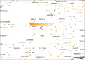
Bagadowoégen (Burkina Faso)Bagadowoégen is a town in Burkina Faso. An overview map of the region around Bagadowoégen is displayed below.
regional and 3d topo map of Bagadowoégen, Burkina Faso ::
Bagadowoégen airports ::
The nearest airport is OUA - Ouagadougou, located 31.8 km east of Bagadowoégen.
Nearby towns ::
Tambeten (1.9km north) //
Ouémhiri (2.6km north east) //
Bingo (3.4km west) //
Sapélo (3.7km north) //
Balolé (3.6km east) //
Nabitenga (3.6km east) //
Pisen (3.7km south) //
Dawanégomdé (4.1km south east) //
Vila (4.1km south west) //
Manéga (4.1km south west) //
Guilé (5.2km north west) //
Dayassémnoré (5.6km east) //
Nabakoutou (5.8km north) //
Sa (5.7km west) //
Balolé (5.9km east) //
Tama Bagma (6.6km north east) //
Samné (6.6km north east) //
Bouli (6.8km east) //
Kaligri (7.5km west) //
Komléla (7.6km south east) //
Sikwamini (7.8km south west) //
Ouansoua (8.3km north east) //
Séguéden (8.3km north east) //
Douaguen (8.4km north east) //
Koudyéré (9.2km south east) //
Taonsogo (10.0km south east) //
Sahongo (10.4km north east) //
Pitmoaga (10.7km south west) //
Goguen (10.7km south east) //
[all distances 'as the bird flies' and approximate] 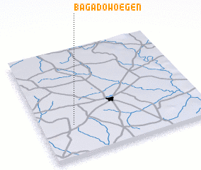 Places with similar names to Bagadowoégen, Burkina Faso :: Disclaimer :: Information on this page comes without warranty of any kind |
||
|
Where is Bagadowoégen? Elevation and coordinates ::
Latitude (lat): 12°18'0"N Longitude (lon): 1°48'0"W
Elevation (approx.): 338m (map arrows pan, magnifying glasses zoom) |
||
|
Visiting Bagadowoégen? Hotel/Accommodation ::
Book a hotel in Bagadowoégen Travel Guide ::
rental cars ::
car rental offers GPS waypoint ::
download a GPX waypoint (PoI) of Bagadowoégen for your GPS receiver
|
||