|
search place name
|
||
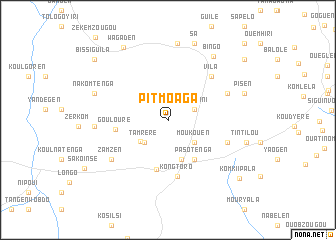
Pitmoaga (Boulkiemdé, Burkina Faso)Pitmoaga is a town in the Boulkiemdé region of Burkina Faso. An overview map of the region around Pitmoaga is displayed below.
regional and 3d topo map of Pitmoaga, Burkina Faso ::
Pitmoaga airports ::
The nearest airport is OUA - Ouagadougou, located 41.6 km east of Pitmoaga.
Nearby towns ::
Sikwamini (3.1km east) //
Tamréré (3.6km south west) //
Douré (3.8km south west) //
Moukouen (3.9km south east) //
Basziri (4.7km south) //
Pasotenga (5.3km south east) //
Kokologo (5.7km south) //
Goulouré (5.8km west) //
Kongtoro (6.4km south) //
Vila (6.8km north east) //
Itao (7.0km east) //
Manéga (7.2km north east) //
Zamzen (7.6km south west) //
Konkwisen (8.0km west) //
Kaligri (8.6km north) //
Bingo (8.6km north east) //
Nakomtenga (8.5km west) //
Pisen (8.9km east) //
Sa (9.0km north) //
Tintilou (8.9km east) //
Wagaden (9.4km north west) //
Komki Ipala (10.2km south east) //
Bissiguila (10.4km north west) //
Bagadowoégen (10.7km north east) //
Tambeten (11.9km north east) //
[all distances 'as the bird flies' and approximate] 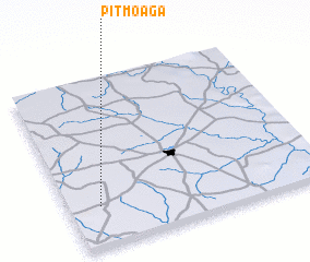 Places with similar names to Pitmoaga, Burkina Faso ::
Disclaimer :: Information on this page comes without warranty of any kind |
||
|
Where is Pitmoaga? Elevation and coordinates ::
Latitude (lat): 12°14'23"N Longitude (lon): 1°52'36"W
Elevation (approx.): 339m (map arrows pan, magnifying glasses zoom) |
||
|
Visiting Pitmoaga? Hotel/Accommodation ::
Book a hotel in Pitmoaga Travel Guide ::
rental cars ::
car rental offers GPS waypoint ::
download a GPX waypoint (PoI) of Pitmoaga for your GPS receiver
|
||