|
search place name
|
||
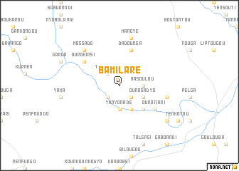
Bamilaré (Burkina Faso)Bamilaré is a town in Burkina Faso. An overview map of the region around Bamilaré is displayed below.
regional and 3d topo map of Bamilaré, Burkina Faso ::
Bamilaré airports ::
The nearest airport is OUA - Ouagadougou, located 207.4 km south west of Bamilaré.
Nearby towns ::
Tomannga (2.6km north west) //
Imanndé (2.6km south west) //
Télowal (2.6km south east) //
Nasoulou (3.6km east) //
Yanyonadé (3.7km south) //
Ouro Sadyo (4.1km south east) //
Tanta (4.1km south east) //
Ouro Alkali (5.2km south east) //
Dadounga (5.8km north) //
Ouro Kirsi (6.6km north west) //
Bilgou (6.6km south east) //
Ouro Tiari (6.6km south east) //
Mangyé (7.6km north) //
Ouro Diami (7.5km east) //
Mossadé (7.8km north west) //
Damkoko (9.1km south east) //
[all distances 'as the bird flies' and approximate] 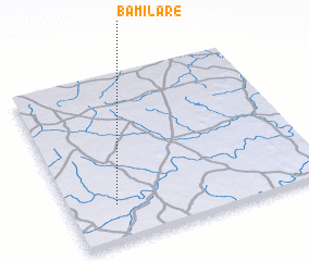 Places with similar names to Bamilaré, Burkina Faso ::
Disclaimer :: Information on this page comes without warranty of any kind |
||
|
Where is Bamilaré? Elevation and coordinates ::
Latitude (lat): 13°13'0"N Longitude (lon): 0°11'0"W
Elevation (approx.): 273m (map arrows pan, magnifying glasses zoom) |
||
|
Visiting Bamilaré? Hotel/Accommodation ::
Book a hotel in Bamilaré Travel Guide ::
rental cars ::
car rental offers GPS waypoint ::
download a GPX waypoint (PoI) of Bamilaré for your GPS receiver
|
||