|
search place name
|
||
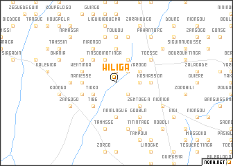
Wiliga (Burkina Faso)Wiliga is a town in Burkina Faso. An overview map of the region around Wiliga is displayed below.
regional and 3d topo map of Wiliga, Burkina Faso ::
Wiliga airports ::
The nearest airport is OUA - Ouagadougou, located 64.8 km north of Wiliga.
Nearby towns ::
Sabin (1.9km north) //
Taniado (2.6km north east) //
Tinboué (2.6km south east) //
Goummsé (3.6km east) //
Tinsobinbtinga (4.1km north west) //
Goudou (4.1km north east) //
Tioko (4.1km south west) //
Yarogo (4.1km north east) //
Tanguin (5.2km north west) //
Daïassemnoré (5.2km south west) //
Tibé (5.2km south west) //
Zemtoéga (5.2km south east) //
Nakonbogo (5.6km north) //
Naniessé (5.4km west) //
Kosmasson (5.4km east) //
Naïalagué (5.6km south) //
Lilbouré (5.6km south) //
Binstéguéré (5.7km west) //
Silkouka (5.7km west) //
Wemtinga (5.7km west) //
Niaongo (6.6km north west) //
Koumnéré (6.6km north west) //
Toéssé (6.6km north east) //
Goubla (6.6km south east) //
Gowin (7.3km west) //
Toudou (7.4km north) //
Daguili (7.6km north) //
Tammssé (7.6km south) //
Lossa (7.6km north) //
[all distances 'as the bird flies' and approximate]  Places with similar names to Wiliga, Burkina Faso ::
Disclaimer :: Information on this page comes without warranty of any kind |
||
|
Where is Wiliga? Elevation and coordinates ::
Latitude (lat): 11°48'0"N Longitude (lon): 1°19'0"W
Elevation (approx.): 294m (map arrows pan, magnifying glasses zoom) |
||
|
Visiting Wiliga? Hotel/Accommodation ::
Book a hotel in Wiliga Travel Guide ::
rental cars ::
car rental offers GPS waypoint ::
download a GPX waypoint (PoI) of Wiliga for your GPS receiver
|
||