|
search place name
|
||
Mutakura (Muyinga, Burundi)Mutakura is a town in the Muyinga region of Burundi. An overview map of the region around Mutakura is displayed below.
regional and 3d topo map of Mutakura, Burundi ::

Mutakura airports ::
The nearest airport is KGL - Kigali Intl, located 83.6 km north of Mutakura.
Other airports nearby include BJM - Bujumbura Intl (137.6 km south west), KME - Kamembe (165.7 km west), GYI - Gisenyi (167.3 km north west), GOM - Goma (169.5 km north west), Nearby towns ::
Butarugera (2.7km north) //
Kinazi (3.3km south east) //
Musave (4.0km south west) //
Kobero (5.3km north east) //
Rugari (5.3km south east) //
Murenge (5.5km north) //
Muhwazi (7.6km south west) //
Butihinda (7.8km south west) //
Rugina (8.8km east) //
Kibande (8.9km south west) //
Mangoma (9.2km north) //
Ntamba (9.5km north west) //
Ntita (9.7km north west) //
Ruhorongo (9.7km north west) //
Kabuyogoma (10.2km south west) //
Gasenyi (10.9km north west) //
[all distances 'as the bird flies' and approximate] 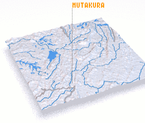 Places with similar names to Mutakura, Burundi ::
// Moetagare (ZA)
// Matukuroa (NZ)
// Mat'-Gora (RU)
// Mitkirey (RU)
// Māitkora (BD)
// Mutukura (BI)
// Madogoré (TD)
// Maïdougouri (TD)
// Médékourou (TD)
// Médi Koura (TD)
Disclaimer :: Information on this page comes without warranty of any kind |
||
|
Where is Mutakura? Elevation and coordinates ::
Latitude (lat): 2°41'6"S Longitude (lon): 30°22'52"E
Elevation (approx.): 1463m (map arrows pan, magnifying glasses zoom) |
||
|
Visiting Mutakura? Hotel/Accommodation ::
Book a hotel in Mutakura Travel Guide ::
Buy a travel guide for Burundi rental cars ::
car rental offers GPS waypoint ::
download a GPX waypoint (PoI) of Mutakura for your GPS receiver
|
||