|
search place name
|
||
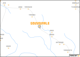
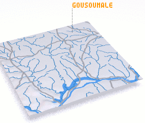
Gousoumalé (Central African Republic)Gousoumalé is a town in Central African Republic. An overview map of the region around Gousoumalé is displayed below.
regional and 3d topo map of Gousoumalé, Central African Republic ::
Gousoumalé airports ::
The nearest airport is BGF - Bangui M Poko, located 221.3 km south west of Gousoumalé.
Other airports nearby include BDT - Gbadolite (226.9 km south east), Nearby towns ::
 Places with similar names to Gousoumalé, Central African Republic ::
// Kasymly (AZ)
// Kazımlı (AZ)
// Qasimbǝyli (AZ)
// Qasımbǝyli (AZ)
// Qasımbǝyli (AZ)
// Qasımbeyli (AZ)
// Qasımlı (AZ)
// Qasımlı (AZ)
// Keys Mill (US)
// Gosaumühle (AT)
Disclaimer :: Information on this page comes without warranty of any kind |
||
|
Where is Gousoumalé? Elevation and coordinates ::
Latitude (lat): 5°56'0"N Longitude (lon): 19°48'0"E
Elevation (approx.): 486m (map arrows pan, magnifying glasses zoom) |
||
|
Visiting Gousoumalé? Hotel/Accommodation ::
Book a hotel in Gousoumalé Travel Guide ::
rental cars ::
car rental offers GPS waypoint ::
download a GPX waypoint (PoI) of Gousoumalé for your GPS receiver
|
||