|
search place name
|
||
Kéra (Moyen-Chari, Chad)Kéra is a town in the Moyen-Chari region of Chad. An overview map of the region around Kéra is displayed below.
regional and 3d topo map of Kéra, Chad ::
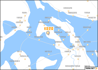
Nearby towns ::
Bembaya (1.9km north) //
Gakédjé (3.7km east) //
Maïbessé (4.1km south west) //
Dornoyon (4.1km south east) //
Kembidé (4.1km south east) //
Mandékaga (4.1km north west) //
Dokou (4.1km north east) //
Bédjo (5.2km south east) //
Dabada (5.2km south east) //
Nangda (5.6km north) //
Tando (5.8km east) //
Manda (7.3km west) //
Mayélé (7.4km south) //
Maïlo (7.3km east) //
Mata (7.5km west) //
Balimba (9.2km south east) //
Kibala (10.4km south east) //
[all distances 'as the bird flies' and approximate] 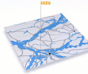 Places with similar names to Kéra, Chad ::
Disclaimer :: Information on this page comes without warranty of any kind |
||
|
Where is Kéra? Elevation and coordinates ::
Latitude (lat): 9°11'0"N Longitude (lon): 18°17'0"E
Elevation (approx.): 365m (map arrows pan, magnifying glasses zoom) |
||
|
Visiting Kéra? Hotel/Accommodation ::
Book a hotel in Kéra Travel Guide ::
Buy a travel guide for Chad rental cars ::
car rental offers GPS waypoint ::
download a GPX waypoint (PoI) of Kéra for your GPS receiver
|
||