|
search place name
|
||
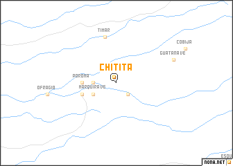
Chitita (Tarapacá, Chile)Chitita is a town in the Tarapacá region of Chile. An overview map of the region around Chitita is displayed below.
regional and 3d topo map of Chitita, Chile ::
Chitita airports ::
The nearest airport is ARI - Arica Chacalluta, located 86.4 km north west of Chitita.
Other airports nearby include TCQ - Tacna Coronel Carlos Ciriani Santa Rosa Intl (105.1 km north west), IQQ - Iquique Diego Aracena Intl (197.3 km south), Nearby towns ::
Palca (2.6km south east) //
Amazaca (3.5km west) //
Guañacagua (3.5km west) //
Marquirave (4.0km south west) //
Poroma (5.3km west) //
Codpa (5.6km west) //
Timar (7.6km north) //
[all distances 'as the bird flies' and approximate] 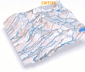 Places with similar names to Chitita, Chile ::
// Chiatat (MA)
// Tiouddit (MA)
// Shadowwood (US)
// Chitid (RO)
// Chododa (RU)
// Shadīdah (IQ)
// Chāh Tūt (IR)
// Shadow Wood (US)
// Shadow Wood (US)
// Chhātādda (BD)
Disclaimer :: Information on this page comes without warranty of any kind |
||
|
Where is Chitita? Elevation and coordinates ::
Latitude (lat): 18°49'0"S Longitude (lon): 69°41'0"W
Elevation (approx.): 2401m (map arrows pan, magnifying glasses zoom) |
||
|
Visiting Chitita? Hotel/Accommodation ::
Book a hotel in Chitita Travel Guide ::
Buy a travel guide for Chile rental cars ::
car rental offers GPS waypoint ::
download a GPX waypoint (PoI) of Chitita for your GPS receiver
|
||