|
search place name
|
||
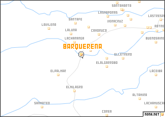
Barquereña (Departamento de Arauca, Colombia)Barquereña is a town in the Departamento de Arauca region of Colombia. An overview map of the region around Barquereña is displayed below.
regional and 3d topo map of Barquereña, Colombia ::
Barquereña airports ::
The nearest airport is TME - Tame, located 71.2 km west of Barquereña.
Other airports nearby include AUC - Arauca Santiago Perez (80.3 km north east), STD - Santo Domingo Mayor Buenaventura Vivas (159.7 km north west), SVZ - San Antonio Del Tachira (212.2 km north west), CUC - Cucuta Camilo Daza (224.6 km north west), Nearby towns ::
Los Caños (2.6km north east) //
La Charanga (4.1km north west) //
Las Delicias (5.5km east) //
El Algarrobo (5.8km east) //
La Luna (6.2km north west) //
El Palmar (6.7km south west) //
Camoruco (6.7km north east) //
Los Trompillos (7.4km north) //
El Milagro (7.6km south) //
Santa Fé (8.3km north) //
La Vileña (10.3km north west) //
Veracruz (10.6km north east) //
[all distances 'as the bird flies' and approximate] 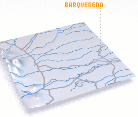 Places with similar names to Barquereña, Colombia ::
// Baiergrün (DE)
// Bergarn (DE)
// Burgrain (DE)
// Burgrain (DE)
// Barcarena (PT)
// Berehy Górne (PL)
// Birch Run (US)
// Bāraikaran (BD)
// Baragrān (IN)
// Bar Kārīn (PK)
Disclaimer :: Information on this page comes without warranty of any kind |
||
|
Where is Barquereña? Elevation and coordinates ::
Latitude (lat): 6°27'0"N Longitude (lon): 71°7'0"W
Elevation (approx.): 134m (map arrows pan, magnifying glasses zoom) |
||
|
Visiting Barquereña? Hotel/Accommodation ::
Book a hotel in Barquereña Travel Guide ::
Buy a travel guide for Colombia rental cars ::
car rental offers GPS waypoint ::
download a GPX waypoint (PoI) of Barquereña for your GPS receiver
|
||