|
search place name
|
||
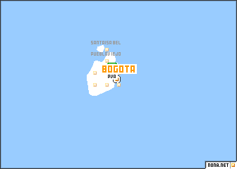
Bogotá (Providencia y Santa Catalina, Departamento de Archipiélago de San Andrés, Colombia)Bogotá is a town in the Providencia y Santa Catalina, Departamento de Archipiélago de San Andrés region of Colombia. An overview map of the region around Bogotá is displayed below.
regional and 3d topo map of Bogotá, Colombia ::
Bogotá airports ::
The nearest airport is PVA - Providencia El Embrujo, located 2.8 km north of Bogotá.
Other airports nearby include ADZ - San Andres Island Gustavo Rojas Pinilla (91.7 km south west), Nearby towns ::
La Paz (0.0km north) //
Rocky Point (1.9km north) //
El Valle (1.9km north) //
Bottom House (1.8km west) //
Lupton (1.8km west) //
Aguamansa (1.8km west) //
Casabaja (3.6km west) //
Bahía Suroeste (3.6km west) //
Ayacucho (4.1km north west) //
Aguadulce (4.1km north west) //
San Felipe (4.1km north west) //
Mountain (4.1km north west) //
Pueblo Viejo (4.1km north west) //
Santa Isabel (5.8km north) //
Jacob (5.8km north) //
Jones Point (5.8km north) //
[all distances 'as the bird flies' and approximate]  Places with similar names to Bogotá, Colombia ::
Disclaimer :: Information on this page comes without warranty of any kind |
||
|
Where is Bogotá? Elevation and coordinates ::
Latitude (lat): 13°20'0"N Longitude (lon): 81°21'0"W
Elevation (approx.): -32768m (map arrows pan, magnifying glasses zoom) |
||
|
Visiting Bogotá? Hotel/Accommodation ::
Book a hotel in Bogotá Travel Guide ::
Buy a travel guide for Colombia rental cars ::
car rental offers GPS waypoint ::
download a GPX waypoint (PoI) of Bogotá for your GPS receiver
|
||