|
search place name
|
||
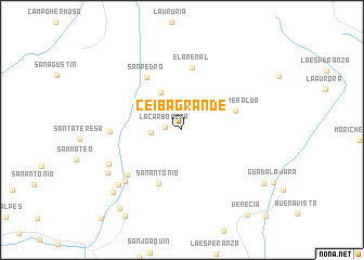
Ceiba Grande (Departamento de Casanare, Colombia)Ceiba Grande is a town in the Departamento de Casanare region of Colombia. An overview map of the region around Ceiba Grande is displayed below.
regional and 3d topo map of Ceiba Grande, Colombia ::
Ceiba Grande airports ::
The nearest airport is VVC - Villavicencio Vanguardia, located 109.3 km south west of Ceiba Grande.
Other airports nearby include BOG - Bogota Eldorado Intl (130.8 km west), TME - Tame (216.2 km north east), Nearby towns ::
La Carbonera (1.7km west) //
Palmichal (3.2km west) //
Las Delicias (4.4km north west) //
La Esmeralda (5.8km east) //
San Antonio (6.1km south west) //
El Arenal (6.5km north) //
San Pedro (6.5km north west) //
El Chiguiro (7.2km south west) //
La Peña del Infierno (7.4km west) //
El Chiguiro (7.8km south west) //
La Granja (8.3km south west) //
La Playa (8.6km south west) //
Maravillas (8.8km south west) //
La Colonia (9.6km south west) //
Argentina (10.1km south east) //
Ayacucho (10.4km south west) //
Venecia (11.0km south east) //
La Rancherita (12.3km south east) //
[all distances 'as the bird flies' and approximate] 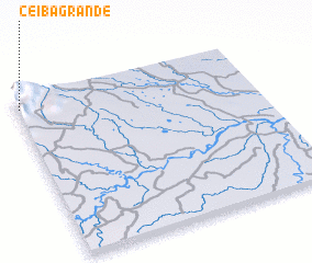 Places with similar names to Ceiba Grande, Colombia ::
// Sabiá Grande (BR)
// Ceiba Grande (CU)
// Cieba Grande (CO)
// Sibikaranto (SN)
// Ceiba Grande (HN)
Disclaimer :: Information on this page comes without warranty of any kind |
||
|
Where is Ceiba Grande? Elevation and coordinates ::
Latitude (lat): 4°56'2"N Longitude (lon): 72°59'27"W
Elevation (approx.): 1080m (map arrows pan, magnifying glasses zoom) |
||
|
Visiting Ceiba Grande? Hotel/Accommodation ::
Book a hotel in Ceiba Grande Travel Guide ::
Buy a travel guide for Colombia rental cars ::
car rental offers GPS waypoint ::
download a GPX waypoint (PoI) of Ceiba Grande for your GPS receiver
|
||