|
search place name
|
||
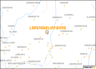
La Peña del Infierno (Boyacá, Colombia)La Peña del Infierno is a town in the Boyacá region of Colombia. An overview map of the region around La Peña del Infierno is displayed below.
regional and 3d topo map of La Peña del Infierno, Colombia ::
La Peña del Infierno airports ::
The nearest airport is VVC - Villavicencio Vanguardia, located 104.7 km south west of La Peña del Infierno.
Other airports nearby include BOG - Bogota Eldorado Intl (123.5 km west), TME - Tame (221.0 km north east), Nearby towns ::
Santa Teresa (3.2km west) //
La Granja (3.3km south) //
Palmichal (4.2km east) //
Maravillas (4.3km south) //
San Mateo (4.5km south west) //
El Chiguiro (4.8km south) //
El Chiguiro (5.3km south) //
La Playa (5.5km south) //
La Carbonera (5.7km east) //
La Colonia (6.3km south) //
Las Delicias (6.6km north east) //
San Pedro (6.7km north east) //
San Antonio (7.4km south east) //
Ceiba Grande (7.4km east) //
San José de Chuy (7.9km south west) //
San Agustín (8.0km north west) //
Ayacucho (8.0km south) //
Sabanalarga (8.9km south) //
San Antonio (9.5km south west) //
El Arenal (10.7km north east) //
[all distances 'as the bird flies' and approximate]  Places with similar names to La Peña del Infierno, Colombia :: Disclaimer :: Information on this page comes without warranty of any kind |
||
|
Where is La Peña del Infierno? Elevation and coordinates ::
Latitude (lat): 4°55'57"N Longitude (lon): 73°3'27"W
Elevation (approx.): 775m (map arrows pan, magnifying glasses zoom) |
||
|
Visiting La Peña del Infierno? Hotel/Accommodation ::
Book a hotel in La Peña del Infierno Travel Guide ::
Buy a travel guide for Colombia rental cars ::
car rental offers GPS waypoint ::
download a GPX waypoint (PoI) of La Peña del Infierno for your GPS receiver
|
||