|
search place name
|
||
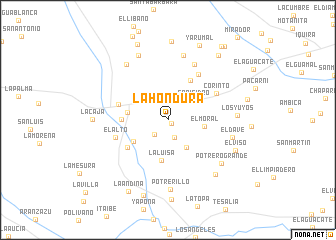
La Hondura (Huila, Colombia)La Hondura is a town in the Huila region of Colombia. An overview map of the region around La Hondura is displayed below.
regional and 3d topo map of La Hondura, Colombia ::
La Hondura airports ::
The nearest airport is NVA - Neiva Benito Salas, located 68.6 km north east of La Hondura.
Other airports nearby include PPN - Popayan Guillermo Leon Valencia (92.5 km west), FLA - Florencia Gustavo Artunduaga Paredes (112.0 km south), SVI - San Vincente De Caguan Eduardo Falla Solano (122.8 km south east), CLO - Cali Alfonso Bonilla Aragon Intl (125.7 km north west), Nearby towns ::
Villaverde (0.6km south east) //
La Esperanza (2.1km south) //
Salamina (2.2km south west) //
San Isidro (3.6km north east) //
La Reforma (3.7km south east) //
El Moral (4.1km east) //
La Luisa (4.6km south) //
Las Nanes (4.6km south west) //
La Agencia (4.6km west) //
Tres Esquinas (5.1km north east) //
Araujo (5.2km west) //
Nátaga (5.5km south west) //
La Cabaña (5.8km west) //
La Palma (6.1km north east) //
El Alto (6.1km west) //
Corinto (6.1km north east) //
Patio Bonito (6.8km north east) //
La Florida (7.4km north) //
El Dave (7.5km east) //
Potrero Grande (7.6km south east) //
Potrerillo (7.7km south) //
Pepinal (7.8km north west) //
Los Yuyos (7.8km east) //
San Antonio (7.9km north west) //
La Judea (8.0km south east) //
El Viso (8.3km south east) //
La Caja (8.4km west) //
La Samaría (8.8km north) //
La Brisa (8.8km south) //
[all distances 'as the bird flies' and approximate]  Places with similar names to La Hondura, Colombia ::
// Lohondry (MG)
// La Hondura (CO)
// La Hondura (CO)
// La Hondura (CO)
// La Hondura (GT)
// La Hondura (MX)
// Lohandar (IR)
// La Hondura (BO)
// La Hunaudière (FR)
Disclaimer :: Information on this page comes without warranty of any kind |
||
|
Where is La Hondura? Elevation and coordinates ::
Latitude (lat): 2°34'36"N Longitude (lon): 75°47'12"W
Elevation (approx.): 1502m (map arrows pan, magnifying glasses zoom) |
||
|
Visiting La Hondura? Hotel/Accommodation ::
Book a hotel in La Hondura Travel Guide ::
Buy a travel guide for Colombia rental cars ::
car rental offers GPS waypoint ::
download a GPX waypoint (PoI) of La Hondura for your GPS receiver
|
||