|
search place name
|
||
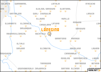
La Regina (Valle del Cauca, Colombia)La Regina is a town in the Valle del Cauca region of Colombia. An overview map of the region around La Regina is displayed below.
regional and 3d topo map of La Regina, Colombia ::
La Regina airports ::
The nearest airport is CLO - Cali Alfonso Bonilla Aragon Intl, located 18.5 km north of La Regina.
Other airports nearby include ULQ - Tulua Farfan (78.7 km north), BUN - Buenaventura Gerardo Tobar Lopez (87.4 km north west), PPN - Popayan Guillermo Leon Valencia (107.2 km south), NVA - Neiva Benito Salas (125.1 km south east), Nearby towns ::
La Alianza (1.9km west) //
Ingenio de Mayangüez (1.9km north) //
Buchitolo (3.7km west) //
Candelaria (3.8km north west) //
San Antonio (4.1km south east) //
La Tupia (4.1km north east) //
El Cabuyal (5.9km south) //
La Gorgona (5.9km west) //
El Lauro (6.7km north west) //
El Higueronal (6.7km north east) //
Ingenio Castilla (7.6km east) //
Chundular (7.6km north) //
Murillo (7.9km north east) //
Gualí (9.3km north west) //
Cañas Abajo (10.5km south east) //
[all distances 'as the bird flies' and approximate]  Places with similar names to La Regina, Colombia ::
// La Región (CU)
// Largino (RU)
// Lorgino (RU)
// La Regina (MX)
// Lārījān (IR)
// Lorījān (IR)
// La Orejona (PE)
// Larajani (PE)
// La Orejana (VE)
// La Orejana (VE)
Disclaimer :: Information on this page comes without warranty of any kind |
||
|
Where is La Regina? Elevation and coordinates ::
Latitude (lat): 3°23'0"N Longitude (lon): 76°20'0"W
Elevation (approx.): 985m (map arrows pan, magnifying glasses zoom) |
||
|
Visiting La Regina? Hotel/Accommodation ::
Book a hotel in La Regina Travel Guide ::
Buy a travel guide for Colombia rental cars ::
car rental offers GPS waypoint ::
download a GPX waypoint (PoI) of La Regina for your GPS receiver
|
||