|
search place name
|
||
San Pedro de Upía (Departamento de Casanare, Colombia)San Pedro de Upía is a town in the Departamento de Casanare region of Colombia. An overview map of the region around San Pedro de Upía is displayed below.
regional and 3d topo map of San Pedro de Upía, Colombia ::

San Pedro de Upía airports ::
The nearest airport is VVC - Villavicencio Vanguardia, located 95.4 km south west of San Pedro de Upía.
Other airports nearby include BOG - Bogota Eldorado Intl (132.8 km west), TME - Tame (232.7 km north east), Nearby towns ::
Aguaclara (6.1km north west) //
La Pica (6.2km north east) //
Matasuelta (6.7km south west) //
Santa Rosita del Tua (7.1km north east) //
El Berruguero (7.1km east) //
La Iguara (8.0km north) //
La Arabia (8.0km west) //
La Bastilla (8.1km south west) //
Algarrobo (8.3km north west) //
Palestina (8.8km north east) //
Los Carpatos (9.3km north west) //
La Estación (10.1km north west) //
El Delirio (10.3km south east) //
[all distances 'as the bird flies' and approximate] 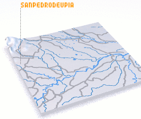 Places with similar names to San Pedro de Upía, Colombia :: Disclaimer :: Information on this page comes without warranty of any kind |
||
|
Where is San Pedro de Upía? Elevation and coordinates ::
Latitude (lat): 4°43'0"N Longitude (lon): 72°57'0"W
Elevation (approx.): 375m (map arrows pan, magnifying glasses zoom) |
||
|
Visiting San Pedro de Upía? Hotel/Accommodation ::
Book a hotel in San Pedro de Upía Travel Guide ::
Buy a travel guide for Colombia rental cars ::
car rental offers GPS waypoint ::
download a GPX waypoint (PoI) of San Pedro de Upía for your GPS receiver
|
||