|
search place name
|
||
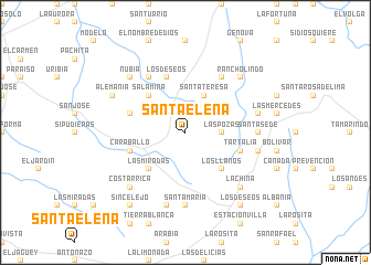
Santa Elena (Magdalena, Colombia)Santa Elena is a town in the Magdalena region of Colombia. An overview map of the region around Santa Elena is displayed below.
regional and 3d topo map of Santa Elena, Colombia ::
Santa Elena airports ::
The nearest airport is BAQ - Barranquilla Ernesto Cortissoz, located 83.3 km north west of Santa Elena.
Other airports nearby include SMR - Santa Marta Simon Bolivar (83.3 km north), VUP - Valledupar Alfonso Lopez Pumarejo (108.0 km east), MGN - Magangue Baracoa (137.3 km south west), CTG - Cartagena Rafael Nunez (140.4 km west), Nearby towns ::
Los Andes (2.6km north west) //
Las Pozas (3.6km east) //
Panamá (4.1km north east) //
La Alicia (4.1km north east) //
Santa Teresa (4.1km north east) //
Los Llanos (5.2km south east) //
Salamina (5.2km north west) //
Las Miradas (5.2km south west) //
La Providencia (5.8km west) //
Tartalia (5.8km east) //
Caraballo (5.8km west) //
Los Deseos (5.9km north) //
El Amparo (6.6km north east) //
Matecaña (6.6km north west) //
Santa Sede (7.3km east) //
Santa María (7.4km south) //
Doña María (7.5km east) //
La Arenosa (7.5km east) //
Francia (7.6km south) //
Costarrica (7.8km south west) //
La China (7.8km south east) //
Nubia (7.8km north west) //
Rancholindo (7.8km north east) //
Alemania (8.2km north west) //
Flores de Seda (9.2km south west) //
Los Deseos (9.2km south east) //
La Estación (9.2km south east) //
Sincelejo (9.2km south west) //
[all distances 'as the bird flies' and approximate]  Places with similar names to Santa Elena, Colombia ::
// Sondalin (MM)
// Santa Elena (BZ)
// Saint Leon (US)
// Santa Elena (PA)
// Santa Elena (PA)
// Sandálion (GR)
// Santa Elena (CU)
// Santa Elena (CU)
// Santa Elena (CU)
// Santa Elena (CU)
Disclaimer :: Information on this page comes without warranty of any kind |
||
|
Where is Santa Elena? Elevation and coordinates ::
Latitude (lat): 10°22'0"N Longitude (lon): 74°14'0"W
Elevation (approx.): 97m (map arrows pan, magnifying glasses zoom) |
||
|
Visiting Santa Elena? Hotel/Accommodation ::
Book a hotel in Santa Elena Travel Guide ::
Buy a travel guide for Colombia rental cars ::
car rental offers GPS waypoint ::
download a GPX waypoint (PoI) of Santa Elena for your GPS receiver
|
||