|
search place name
|
||
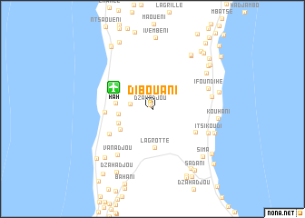
Dibouani (Grande Comore, Comoros)Dibouani is a town in the Grande Comore region of Comoros. An overview map of the region around Dibouani is displayed below.
regional and 3d topo map of Dibouani, Comoros ::
Dibouani airports ::
The nearest airport is HAH - Moroni Prince Said Ibrahim, located 5.3 km north west of Dibouani.
Other airports nearby include NWA - Moheli Bandaressalam (95.6 km south east), AJN - Anjouan Ouani (137.2 km south east), DZA - Dzaoudzi Pamandzi (254.7 km south east), Nearby towns ::
Dzahadjou (0.6km north west) //
Milévani (2.7km west) //
Bouenindi (4.1km west) //
Bibavou (4.4km south west) //
Mbaléni (4.5km west) //
Bangahani (4.6km south west) //
La Grotte (4.8km south) //
Hahaïa (5.7km west) //
Dzaheni (6.0km south east) //
Oussivo (6.0km south west) //
Vanadjou (7.0km south west) //
Ifoundihé (7.2km east) //
Héroumbili (7.3km east) //
Itsikoudi (7.3km south east) //
Mnoungou (7.8km north east) //
Batou (8.0km north east) //
Touaïfa (8.1km north east) //
Kouhani (8.0km east) //
Hambo (8.1km east) //
Vounambadani (8.3km south west) //
Kangalinda (8.3km east) //
Sima (8.5km south east) //
Sada-Chihoué (8.5km north east) //
Koimbani (8.7km south east) //
Ivembeni (8.8km north) //
Salémani (8.7km north east) //
Dzahadjou (8.9km south west) //
Domoni Adjou (9.1km north west) //
Vanambouani (9.0km south west) //
[all distances 'as the bird flies' and approximate] 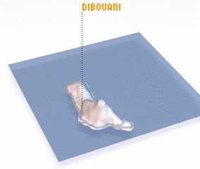 Places with similar names to Dibouani, Comoros ::
Disclaimer :: Information on this page comes without warranty of any kind |
||
|
Where is Dibouani? Elevation and coordinates ::
Latitude (lat): 11°33'25"S Longitude (lon): 43°18'52"E
Elevation (approx.): 367m (map arrows pan, magnifying glasses zoom) |
||
|
Visiting Dibouani? Hotel/Accommodation ::
Book a hotel in Dibouani Travel Guide ::
Buy a travel guide for Comoros rental cars ::
car rental offers GPS waypoint ::
download a GPX waypoint (PoI) of Dibouani for your GPS receiver
|
||