|
search place name
|
||
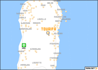
Touaïfa (Grande Comore, Comoros)Touaïfa is a town in the Grande Comore region of Comoros. An overview map of the region around Touaïfa is displayed below.
regional and 3d topo map of Touaïfa, Comoros ::
Touaïfa airports ::
The nearest airport is HAH - Moroni Prince Said Ibrahim, located 10.2 km south west of Touaïfa.
Other airports nearby include NWA - Moheli Bandaressalam (99.1 km south east), AJN - Anjouan Ouani (136.3 km south east), DZA - Dzaoudzi Pamandzi (254.5 km south east), Nearby towns ::
Batou (0.1km south) //
Kourani (1.3km east) //
Sada Mouamboua (1.6km east) //
Mbéni (2.2km east) //
Mdjibari (2.3km north east) //
Sada-Chihoué (2.4km south east) //
Salémani (2.5km south east) //
Dimadjou (2.8km north) //
Mnoungou (2.9km south east) //
Bambadjani (3.0km north east) //
Bouni (3.6km east) //
Séléyani (3.6km east) //
Niadoumbouéni (3.9km north east) //
Itsandzéni (4.0km north east) //
Mouadja (4.5km north east) //
Ifoundihé (4.6km south east) //
Ouéla (4.6km north east) //
Ivembeni (4.8km north west) //
Ngolé (4.9km north east) //
Kangalinda (5.6km south east) //
Héroumbili (5.7km south east) //
Mbatsé (5.9km north east) //
La Grille (5.9km north west) //
Maouéni (5.9km north west) //
Founga (7.4km north west) //
Nioumamilina (7.6km north east) //
Dzahadjou (7.9km south west) //
Dibouani (8.1km south west) //
Chezani (8.4km north east) //
[all distances 'as the bird flies' and approximate]  Places with similar names to Touaïfa, Comoros ::
Disclaimer :: Information on this page comes without warranty of any kind |
||
|
Where is Touaïfa? Elevation and coordinates ::
Latitude (lat): 11°29'51"S Longitude (lon): 43°21'27"E
Elevation (approx.): 922m (map arrows pan, magnifying glasses zoom) |
||
|
Visiting Touaïfa? Hotel/Accommodation ::
Book a hotel in Touaïfa Travel Guide ::
Buy a travel guide for Comoros rental cars ::
car rental offers GPS waypoint ::
download a GPX waypoint (PoI) of Touaïfa for your GPS receiver
|
||