|
search place name
|
||
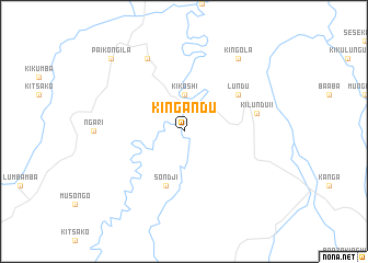
Kingandu (Congo, Democratic Republic of the)Kingandu is a town in Congo, Democratic Republic of the. An overview map of the region around Kingandu is displayed below.
regional and 3d topo map of Kingandu, Congo, Democratic Republic of the ::
Kingandu airports ::
The nearest airport is KKW - Kikwit, located 65.6 km north east of Kingandu.
Nearby towns ::
Kikoshi (3.7km north) //
Sondji (5.9km south) //
Lundu (6.7km north east) //
Kilundu II (7.6km east) //
Kibwanga (8.3km north west) //
Kingola (9.3km north east) //
Pai-Kongila (10.5km north west) //
[all distances 'as the bird flies' and approximate] 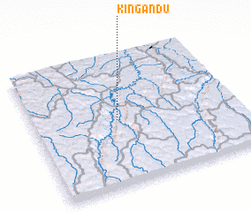 Places with similar names to Kingandu, Congo, Democratic Republic of the ::
// Güneykǝnd (AZ)
// Köhnǝkǝnd (AZ)
// Cangandí (PA)
// Canquintú (PA)
// Kānī Kand (IQ)
// Kāwnagūnd (IQ)
// Kunegundow (PL)
// Güneykent (TR)
// Gunagunīt (ET)
// Gaon Kāndia (BD)
Disclaimer :: Information on this page comes without warranty of any kind |
||
|
Where is Kingandu? Elevation and coordinates ::
Latitude (lat): 5°30'0"S Longitude (lon): 18°25'0"E
Elevation (approx.): 414m (map arrows pan, magnifying glasses zoom) |
||
|
Visiting Kingandu? Hotel/Accommodation ::
Book a hotel in Kingandu Travel Guide ::
rental cars ::
car rental offers GPS waypoint ::
download a GPX waypoint (PoI) of Kingandu for your GPS receiver
|
||