|
search place name
|
||
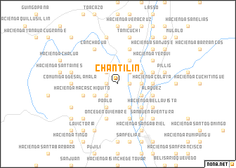
Chantilín (Cotopaxi, Ecuador)Chantilín is a town in the Cotopaxi region of Ecuador. An overview map of the region around Chantilín is displayed below.
regional and 3d topo map of Chantilín, Ecuador ::
Chantilín airports ::
The nearest airport is ATF - Ambato Chachoan, located 40.9 km south of Chantilín.
Other airports nearby include UIO - Quito Mariscal Sucre Intl (80.4 km north), XMS - Macas Coronel E Carvajal (170.7 km south), OCC - Coca Francisco De Orellana (190.0 km east), GYE - Guayaquil Jose Joaquin De Olmedo Intl (199.4 km south west), Nearby towns ::
Hacienda Cachipamba (1.9km west) //
Hacienda Nintanga Alto (1.9km east) //
Hacienda Nintanga Vásconez (1.9km east) //
Hacienda Nintanga Bajo (1.9km east) //
Saquisilí (2.6km north west) //
Hacienda La Rioja (2.6km south west) //
Hacienda Guaitacamito (2.6km north east) //
Hacienda Laigua de Maldonado (3.7km east) //
Hacienda Rumipamba (3.7km east) //
Poaló (4.1km south west) //
Hacienda Tilipulito (4.1km south west) //
Hacienda La Compañía (4.1km south west) //
Guaytacama (4.1km north east) //
Hacienda San Enrique (4.1km south east) //
Hacienda La Calera (4.1km south east) //
Hacienda Guaitacama (4.1km north east) //
Hacienda Laigua del Colegio (4.1km south east) //
Hacienda Laigua de Rivadeneira (5.2km south east) //
Hacienda Laigua de Estupiñán (5.2km south east) //
Hacienda Colaya Grande (5.6km east) //
Hacienda Colaya (5.6km east) //
Once de Noviembre (5.9km south) //
Hacienda Tilipulo (5.9km south) //
Hacienda Macas Chiquito (5.9km west) //
Hacienda Avelina (5.9km north) //
Hacienda Rumipamba del Colegio (5.9km south) //
Hacienda San Roque (5.9km east) //
Joseguango Bajo (5.9km east) //
Aláquez (5.9km east) //
[all distances 'as the bird flies' and approximate] 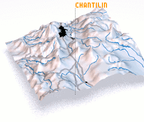 Places with similar names to Chantilín, Ecuador ::
// Chandolin (CH)
// Chindalani (KR)
Disclaimer :: Information on this page comes without warranty of any kind |
||
|
Where is Chantilín? Elevation and coordinates ::
Latitude (lat): 0°51'0"S Longitude (lon): 78°39'0"W
Elevation (approx.): 2892m (map arrows pan, magnifying glasses zoom) |
||
|
Visiting Chantilín? Hotel/Accommodation ::
Book a hotel in Chantilín Travel Guide ::
Buy a travel guide for Ecuador rental cars ::
car rental offers GPS waypoint ::
download a GPX waypoint (PoI) of Chantilín for your GPS receiver
|
||