|
search place name
|
||
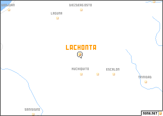
La Chonta (Manabí, Ecuador)La Chonta is a town in the Manabí region of Ecuador. An overview map of the region around La Chonta is displayed below.
regional and 3d topo map of La Chonta, Ecuador ::
La Chonta airports ::
The nearest airport is PVO - Portoviejo Reales Tamarindos, located 97.7 km south west of La Chonta.
Other airports nearby include MEC - Manta Eloy Alfaro Intl (101.6 km south west), UIO - Quito Mariscal Sucre Intl (178.0 km east), ATF - Ambato Chachoan (198.8 km south east), GYE - Guayaquil Jose Joaquin De Olmedo Intl (212.1 km south), Nearby towns ::
Muchiquito (3.7km south) //
Convento (5.2km south east) //
Escalón (8.3km south east) //
[all distances 'as the bird flies' and approximate] 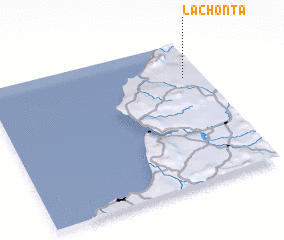 Places with similar names to La Chonta, Ecuador ::
// Le Chainet (FR)
// Lechinţa (RO)
// Lechinţa (RO)
// Lechinţa (RO)
// La Chonta (EC)
// La Chonta (EC)
// La Chonita (MX)
// Le Chenit (CH)
// Luchente (ES)
// Lochend (GB)
Disclaimer :: Information on this page comes without warranty of any kind |
||
|
Where is La Chonta? Elevation and coordinates ::
Latitude (lat): 0°15'0"S Longitude (lon): 80°5'0"W
Elevation (approx.): 444m (map arrows pan, magnifying glasses zoom) |
||
|
Visiting La Chonta? Hotel/Accommodation ::
Book a hotel in La Chonta Travel Guide ::
Buy a travel guide for Ecuador rental cars ::
car rental offers GPS waypoint ::
download a GPX waypoint (PoI) of La Chonta for your GPS receiver
|
||