|
search place name
|
||
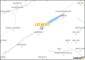
Le Chenit (Aargau, Switzerland)Le Chenit is a town in the Aargau region of Switzerland. An overview map of the region around Le Chenit is displayed below.
regional and 3d topo map of Le Chenit, Switzerland ::
Le Chenit airports ::
The nearest airport is GVA - Geneva Cointrin, located 41.4 km south of Le Chenit.
Other airports nearby include QNJ - Annemasse (45.4 km south), NCY - Annecy Meythet (75.3 km south), DLE - Dole Tavaux (78.5 km north west), XBK - Bourg Ceyzeriat (84.9 km south west), Nearby towns ::
Le Sentier (1.9km north) //
Le Brassus (2.2km south west) //
[all distances 'as the bird flies' and approximate] 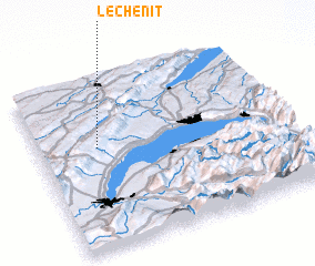 Places with similar names to Le Chenit, Switzerland ::
// Le Chainet (FR)
// Lechinţa (RO)
// Lechinţa (RO)
// Lechinţa (RO)
// La Chonta (EC)
// La Chonta (EC)
// La Chonta (EC)
// La Chonita (MX)
// Luchente (ES)
// Lochend (GB)
Disclaimer :: Information on this page comes without warranty of any kind |
||
|
Where is Le Chenit? Elevation and coordinates ::
Latitude (lat): 46°36'0"N Longitude (lon): 6°14'0"E
Elevation (approx.): 1015m (map arrows pan, magnifying glasses zoom) |
||
|
Visiting Le Chenit? Hotel/Accommodation ::
Book a hotel in Le Chenit Travel Guide ::
Buy a travel guide for Switzerland rental cars ::
car rental offers GPS waypoint ::
download a GPX waypoint (PoI) of Le Chenit for your GPS receiver
|
||