|
search place name
|
||
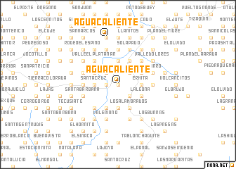
Agua Caliente (Chiquimula, Guatemala)Agua Caliente is a town in the Chiquimula region of Guatemala. An overview map of the region around Agua Caliente is displayed below.
regional and 3d topo map of Agua Caliente, Guatemala ::
Agua Caliente airports ::
The nearest airport is GUA - Guatemala City La Aurora, located 113.3 km west of Agua Caliente.
Other airports nearby include SAL - San Salvador El Salvador Intl (122.5 km south), CBV - Coban (148.9 km north west), SAP - San Pedro Sula La Mesa Intl (200.1 km north east), Nearby towns ::
Obraje (0.0km north) //
San Antonio (1.8km west) //
Las Marías (1.8km west) //
Limones (2.6km north east) //
Cruz Calle (2.6km north east) //
Conacaste (2.6km south east) //
Tisizón (2.6km north west) //
Ermita (3.6km east) //
Rodeo Las Lajas (3.7km north) //
Las Chivas (3.7km south) //
Los Pozos (3.6km west) //
Santa Cruz (3.6km west) //
Carrizal (3.6km west) //
Los Vasos (4.0km north east) //
Las Anonas (4.1km north east) //
San Isidro (4.1km north east) //
La Leona (4.0km south east) //
Los Alambrados (4.1km south east) //
La Soledad (4.0km north west) //
Candelaria (4.0km north west) //
Platanar (4.0km north west) //
Llano Grande (4.1km south west) //
Quesera (5.2km north east) //
Valle Arriba (5.2km north east) //
Pueblo Viejo (5.2km north west) //
Valle El Platanar (5.2km north west) //
Santa Anita (5.2km south west) //
El Cuje (5.4km west) //
Cuesta El Pito (5.4km east) //
[all distances 'as the bird flies' and approximate] 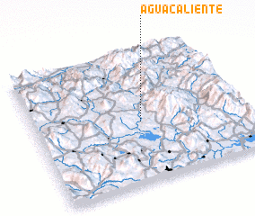 Places with similar names to Agua Caliente, Guatemala ::
// Agua Caliente (BO)
// Agua Caliente (BO)
// Agua Caliente (BO)
// Agua Caliente (BO)
// Agua Caliente (US)
// Agua Caliente (US)
// Agua Caliente (PA)
// Agua Caliente (CO)
// Agua Caliente (CO)
// Aguacaliente (CO)
Disclaimer :: Information on this page comes without warranty of any kind |
||
|
Where is Agua Caliente? Elevation and coordinates ::
Latitude (lat): 14°28'0"N Longitude (lon): 89°29'0"W
Elevation (approx.): 612m (map arrows pan, magnifying glasses zoom) |
||
|
Visiting Agua Caliente? Hotel/Accommodation ::
Book a hotel in Agua Caliente Travel Guide ::
Buy a travel guide for Guatemala rental cars ::
car rental offers GPS waypoint ::
download a GPX waypoint (PoI) of Agua Caliente for your GPS receiver
|
||