|
search place name
|
||
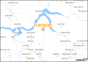
Chitucán (Baja Verapaz, Guatemala)Chitucán is a town in the Baja Verapaz region of Guatemala. An overview map of the region around Chitucán is displayed below.
regional and 3d topo map of Chitucán, Guatemala ::
Chitucán airports ::
The nearest airport is CBV - Coban, located 31.4 km north of Chitucán.
Other airports nearby include GUA - Guatemala City La Aurora (68.3 km south), TAP - Tapachula Intl (206.1 km west), SAL - San Salvador El Salvador Intl (249.3 km south east), Nearby towns ::
Buena Vista (5.7km east) //
La Laguna (5.7km west) //
Vegas Santo Domingo (5.8km south) //
Patixlán (6.5km south west) //
Las Vegas (6.5km south west) //
Canchún (7.4km east) //
Río Negro (7.6km north) //
Xeococ (7.7km south west) //
Xolcoy (10.3km south west) //
[all distances 'as the bird flies' and approximate]  Places with similar names to Chitucán, Guatemala ::
// Chodków Nowy (PL)
// Shtiqën (AL)
// Chiţcani (RO)
// Chiţcani (RO)
// Chitkan (RU)
// Shaytakān (IQ)
// Chādgān (IR)
// Chah Dogāneh (IR)
// Chauddakāni (BD)
// Chitocán (GT)
Disclaimer :: Information on this page comes without warranty of any kind |
||
|
Where is Chitucán? Elevation and coordinates ::
Latitude (lat): 15°12'0"N Longitude (lon): 90°30'0"W
Elevation (approx.): 1372m (map arrows pan, magnifying glasses zoom) |
||
|
Visiting Chitucán? Hotel/Accommodation ::
Book a hotel in Chitucán Travel Guide ::
Buy a travel guide for Guatemala rental cars ::
car rental offers GPS waypoint ::
download a GPX waypoint (PoI) of Chitucán for your GPS receiver
|
||