|
search place name
|
||
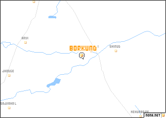
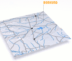
Borkund (Mahārāshtra, India)Borkund is a town in the Mahārāshtra region of India. An overview map of the region around Borkund is displayed below.
regional and 3d topo map of Borkund, India ::
Borkund airports ::
The nearest airport is IXU - Aurangabad, located 109.9 km south east of Borkund.
Other airports nearby include ISK - Nasik Road (134.6 km south west), NMB - Daman (209.6 km west), BDQ - Baroda Vadodara (246.0 km north west), BOM - Bombay Chhatrapati Shivaji Intl (272.3 km south west), Nearby towns ::
 Places with similar names to Borkund, India ::
// Burkuntē (ET)
// Bergante (PH)
// Borgunto (IT)
// Brugneto (IT)
// Börgönd (HU)
// Bergüenda (ES)
// Burgunda (RU)
// Burgunda (RU)
// Bāraikānda (BD)
// Barai Kāndi (BD)
Disclaimer :: Information on this page comes without warranty of any kind |
||
|
Where is Borkund? Elevation and coordinates ::
Latitude (lat): 20°42'0"N Longitude (lon): 74°50'0"E
Elevation (approx.): 331m (map arrows pan, magnifying glasses zoom) |
||
|
Visiting Borkund? Hotel/Accommodation ::
Book a hotel in Borkund Travel Guide ::
Buy a travel guide for India rental cars ::
car rental offers GPS waypoint ::
download a GPX waypoint (PoI) of Borkund for your GPS receiver
|
||