|
search place name
|
||
Labartal (Jammu and Kashmīr, India)Labartal is a town in the Jammu and Kashmīr region of India. An overview map of the region around Labartal is displayed below.
regional and 3d topo map of Labartal, India ::

Labartal airports ::
The nearest airport is SXR - Srinagar, located 9.8 km south east of Labartal.
Other airports nearby include RAZ - Rawala Kot Rawalakot (83.9 km west), MFG - Muzaffarabad (113.4 km west), IXJ - Jammu (149.2 km south), ISB - Islamabad Chaklala (153.3 km west), Nearby towns ::
Chandapura (1.1km north west) //
Dansnār (1.1km south east) //
Patilbāgh (1.2km north east) //
Alīpur (1.1km north east) //
Dadyun (1.4km east) //
Betabāgh (1.6km east) //
Poshur (1.9km south west) //
Sāratpur (1.8km west) //
Garind Khurd (2.2km north) //
Shūlīpur (2.2km south) //
Nandondpura (2.1km north west) //
Wattarwain (1.9km east) //
Lakhrīpura (2.0km south east) //
Suranhāl (2.3km north west) //
Batapur (2.3km north west) //
Kākinmaran (2.5km north east) //
Bonahāma (2.4km south west) //
Māhwara (2.7km south east) //
Deji (2.5km west) //
Nasarullahpur (2.7km north east) //
Hīwudar (2.9km south east) //
Pūnchgund (2.5km west) //
Shyālkut (3.0km south) //
Garind Kalān (3.1km north) //
Pāras (3.0km south west) //
Dafpur (2.8km north east) //
Nijul (2.9km north west) //
Pathānpura (3.1km north east) //
Gund (3.4km north) //
[all distances 'as the bird flies' and approximate] 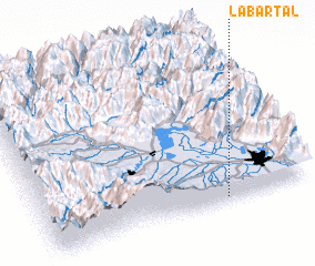 Places with similar names to Labartal, India ::
Disclaimer :: Information on this page comes without warranty of any kind |
||
|
Where is Labartal? Elevation and coordinates ::
Latitude (lat): 34°1'40"N Longitude (lon): 74°40'50"E
Elevation (approx.): 1682m (map arrows pan, magnifying glasses zoom) |
||
|
Visiting Labartal? Hotel/Accommodation ::
Book a hotel in Labartal Travel Guide ::
Buy a travel guide for India rental cars ::
car rental offers GPS waypoint ::
download a GPX waypoint (PoI) of Labartal for your GPS receiver
|
||