|
search place name
|
||
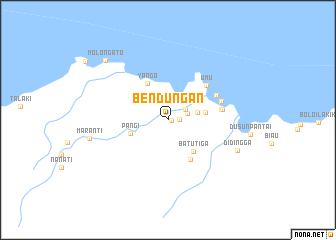
Bendungan (Sulawesi Utara, Indonesia)Bendungan is a town in the Sulawesi Utara region of Indonesia. An overview map of the region around Bendungan is displayed below.
regional and 3d topo map of Bendungan, Indonesia ::
Bendungan airports ::
The nearest airport is GTO - Gorontalo Jalaluddin, located 88.4 km south east of Bendungan.
Nearby towns ::
Hepu (0.3km east) //
Hepu (1.3km east) //
Durian (2.3km east) //
Wawohu (2.3km north east) //
Durian (3.3km east) //
Moyongo (4.2km east) //
Pangi (4.4km west) //
Batutiga (4.5km south east) //
Yango (4.7km north west) //
Sesma (5.1km south east) //
Umu (5.8km north east) //
Kotajin (6.0km north east) //
Tolinggula (6.1km east) //
Tolinggula (6.2km east) //
Sakulati (6.3km east) //
Didingga (8.4km south east) //
Maranti (9.0km west) //
Molongato (9.6km north west) //
[all distances 'as the bird flies' and approximate] 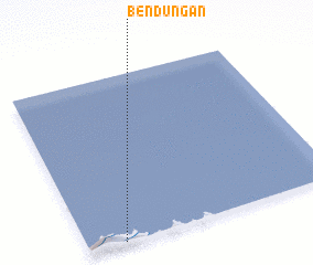 Places with similar names to Bendungan, Indonesia ::
// Bantañgan (PH)
// Binotongan (PH)
// Bintangan (PH)
// Ban Daeng Noi (TH)
// Ban Daeng Noi (TH)
// Ban Dan Ngan (TH)
// Ban Dong Noi (TH)
// Ban Dong Noi (TH)
// Ban Dong Noi (TH)
// Ban Dong Noi (TH)
Disclaimer :: Information on this page comes without warranty of any kind |
||
|
Where is Bendungan? Elevation and coordinates ::
Latitude (lat): 1°0'24"N Longitude (lon): 122°8'45"E
Elevation (approx.): 18m (map arrows pan, magnifying glasses zoom) |
||
|
Visiting Bendungan? Hotel/Accommodation ::
Book a hotel in Bendungan Travel Guide ::
Buy a travel guide for Indonesia rental cars ::
car rental offers GPS waypoint ::
download a GPX waypoint (PoI) of Bendungan for your GPS receiver
|
||