|
search place name
|
||
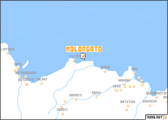
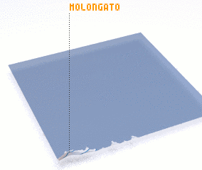
Molongato (Indonesia)Molongato is a town in Indonesia. An overview map of the region around Molongato is displayed below.
regional and 3d topo map of Molongato, Indonesia ::
Molongato airports ::
The nearest airport is GTO - Gorontalo Jalaluddin, located 97.6 km south east of Molongato.
Nearby towns ::
 Places with similar names to Molongato, Indonesia ::
// Mały Nagodów (PL)
// Malyy Ungut (RU)
// Millinocket (US)
// Milangodaa (ID)
// Mulanegoda (LK)
// Malankadi (NE)
// Mbèlongout (SN)
// Mulongoti (ZM)
// Mlingoti (TZ)
// Mulungūtti (PK)
Disclaimer :: Information on this page comes without warranty of any kind |
||
|
Where is Molongato? Elevation and coordinates ::
Latitude (lat): 1°4'0"N Longitude (lon): 122°5'0"E
Elevation (approx.): -32768m (map arrows pan, magnifying glasses zoom) |
||
|
Visiting Molongato? Hotel/Accommodation ::
Book a hotel in Molongato Travel Guide ::
Buy a travel guide for Indonesia rental cars ::
car rental offers GPS waypoint ::
download a GPX waypoint (PoI) of Molongato for your GPS receiver
|
||