|
search place name
|
||
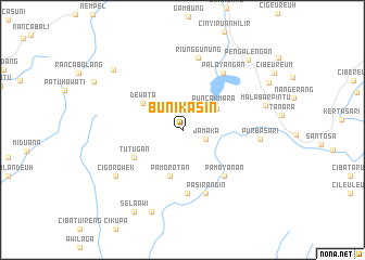
Bunikasin (Jawa Barat, Indonesia)Bunikasin is a town in the Jawa Barat region of Indonesia. An overview map of the region around Bunikasin is displayed below.
regional and 3d topo map of Bunikasin, Indonesia ::
Bunikasin airports ::
The nearest airport is CGK - Jakarta Soekarno Hatta Intl, located 155.5 km north west of Bunikasin.
Nearby towns ::
Jamaka (2.6km east) //
Pallima (2.8km north) //
Puncakmara (4.0km north east) //
Pasirmalang (4.1km north east) //
Pamorotan (4.9km south) //
Dewata (4.9km north west) //
Tutugan (5.7km south west) //
Cicayur (6.3km south east) //
Pamoyanan (6.3km south east) //
Ciheulang (6.6km south) //
Pasirangin (7.0km south) //
Palayangan (7.2km north east) //
Riunggunung (7.6km north) //
Purbasari (8.0km east) //
Babakan (8.3km south west) //
Cigorowek (8.3km south west) //
Malabarpintu (8.9km east) //
Nyalindung (9.0km south) //
Kawahciwidey (9.4km north west) //
Selaawi (9.8km south west) //
Pengalengan (9.8km north east) //
[all distances 'as the bird flies' and approximate]  Places with similar names to Bunikasin, Indonesia ::
// Bancasan (PH)
// Bungsuan (PH)
// Bennigsen (DE)
// Böingsen (DE)
// Bönnigsen (DE)
// Ban Kaeo Saen (TH)
// Ban Kao Son (TH)
// Ban Ko San (TH)
// Benczyn (PL)
// Benacazón (ES)
Disclaimer :: Information on this page comes without warranty of any kind |
||
|
Where is Bunikasin? Elevation and coordinates ::
Latitude (lat): 7°14'28"S Longitude (lon): 107°30'42"E
Elevation (approx.): 1444m (map arrows pan, magnifying glasses zoom) |
||
|
Visiting Bunikasin? Hotel/Accommodation ::
Book a hotel in Bunikasin Travel Guide ::
Buy a travel guide for Indonesia rental cars ::
car rental offers GPS waypoint ::
download a GPX waypoint (PoI) of Bunikasin for your GPS receiver
|
||