|
search place name
|
||
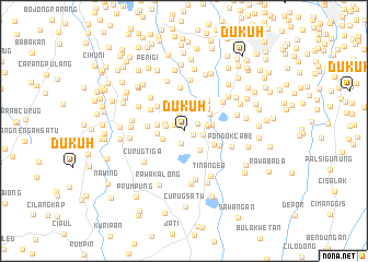
Dukuh (Indonesia)Dukuh is a town in Indonesia. An overview map of the region around Dukuh is displayed below.
regional and 3d topo map of Dukuh, Indonesia ::
Dukuh airports ::
The nearest airport is CGK - Jakarta Soekarno Hatta Intl, located 23.1 km north of Dukuh.
Nearby towns ::
Bambuapus (1.0km south east) //
Pabuatan (1.1km north west) //
Cileduk (1.4km south) //
Kedawung (1.6km north east) //
Saruadukuh (1.6km north) //
Parungbeunying (1.9km west) //
Sasaktinggi (2.0km east) //
Marugak (2.1km west) //
Parakan (2.3km west) //
Pondokcabe Hilir (2.4km east) //
Pamulang (2.5km south east) //
Cimanggis (2.6km east) //
Pondok-sentul (2.7km west) //
Meruya (2.8km west) //
Bulakbumi (2.8km north) //
Legoso (2.9km east) //
Ciputa (3.1km north east) //
Cilalung (3.1km north west) //
Cipayung (3.3km south east) //
Poncol (3.3km north east) //
Jombang (3.4km north west) //
Kampunggunung (3.7km north west) //
Ciater-tengah (3.7km west) //
Cipayung (3.9km south east) //
Kampungutan (3.9km north east) //
Pondokkeso (4.0km north west) //
Tegalrotan (4.4km north) //
Jombang-kulon (4.8km north west) //
Rempoa (4.9km north east) //
[all distances 'as the bird flies' and approximate] 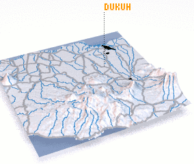 Places with similar names to Dukuh, Indonesia ::
Disclaimer :: Information on this page comes without warranty of any kind |
||
|
Where is Dukuh? Elevation and coordinates ::
Latitude (lat): 6°19'21"S Longitude (lon): 106°43'29"E
Elevation (approx.): 55m (map arrows pan, magnifying glasses zoom) |
||
|
Visiting Dukuh? Hotel/Accommodation ::
Book a hotel in Dukuh Travel Guide ::
Buy a travel guide for Indonesia rental cars ::
car rental offers GPS waypoint ::
download a GPX waypoint (PoI) of Dukuh for your GPS receiver
|
||