|
search place name
|
||
Nenuk (Nusa Tenggara Timur, Indonesia)Nenuk is a town in the Nusa Tenggara Timur region of Indonesia. An overview map of the region around Nenuk is displayed below.
regional and 3d topo map of Nenuk, Indonesia ::

Nenuk airports ::
The nearest airport is DIL - Dili Presidente Nicolau Lobato Intl, located 97.5 km north east of Nenuk.
Nearby towns ::
Wekabu (0.5km north west) //
Lalian (1.1km south east) //
Kianraiikun (1.1km east) //
Batumera (1.5km south west) //
Kotafoun (1.7km north east) //
Debobot (1.7km east) //
Kilosepuluh (1.8km south) //
Kianraiikun (2.2km south east) //
Takabikan (2.2km south) //
Weberliku (2.7km west) //
Kotafoun (2.8km west) //
Nufuaf (3.1km north) //
Naresa (3.1km south) //
Motabuik (3.1km north) //
Buburlulik (3.3km west) //
Bauatok (3.3km north) //
Tubakioan (3.6km north) //
Tubaki (3.7km north) //
Lalosuk (3.9km north) //
Halikelen A (4.1km south) //
Tubatan (4.2km west) //
Mandas (4.3km north) //
Bestaesfehan (4.3km north) //
Taeksoruk (4.5km east) //
Asuulun (4.6km north) //
Loloa (4.6km north) //
Halituku (4.7km north west) //
Haliren (5.0km north) //
Berkase (5.0km north west) //
[all distances 'as the bird flies' and approximate] 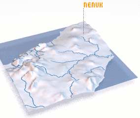 Places with similar names to Nenuk, Indonesia ::
Disclaimer :: Information on this page comes without warranty of any kind |
||
|
Where is Nenuk? Elevation and coordinates ::
Latitude (lat): 9°9'53"S Longitude (lon): 124°53'36"E
Elevation (approx.): 403m (map arrows pan, magnifying glasses zoom) |
||
|
Visiting Nenuk? Hotel/Accommodation ::
Book a hotel in Nenuk Travel Guide ::
Buy a travel guide for Indonesia rental cars ::
car rental offers GPS waypoint ::
download a GPX waypoint (PoI) of Nenuk for your GPS receiver
|
||