|
search place name
|
||
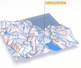
Sangginora (Sulawesi Tengah, Indonesia)Sangginora is a town in the Sulawesi Tengah region of Indonesia. An overview map of the region around Sangginora is displayed below.
regional and 3d topo map of Sangginora, Indonesia ::

Sangginora airports ::
The nearest airport is PSJ - Poso Kasiguncu, located 17.5 km north of Sangginora.
Other airports nearby include PLW - Palu Mutiara (107.8 km north west), Nearby towns ::
 Places with similar names to Sangginora, Indonesia ::
// Zenkanur (RU)
// Sanganoro (MG)
// San Nicanor (EC)
// Sānganer (IN)
// Sāngāner (IN)
// Sanganere (GH)
// Zangon Ara (NE)
// Sanganare (NG)
// Sangnae-ri (KP)
// Sŏngnae-ri (KP)
Disclaimer :: Information on this page comes without warranty of any kind |
||
|
Where is Sangginora? Elevation and coordinates ::
Latitude (lat): 1°34'19"S Longitude (lon): 120°37'44"E
Elevation (approx.): 223m (map arrows pan, magnifying glasses zoom) |
||
|
Visiting Sangginora? Hotel/Accommodation ::
Book a hotel in Sangginora Travel Guide ::
Buy a travel guide for Indonesia rental cars ::
car rental offers GPS waypoint ::
download a GPX waypoint (PoI) of Sangginora for your GPS receiver
|
||