|
search place name
|
||
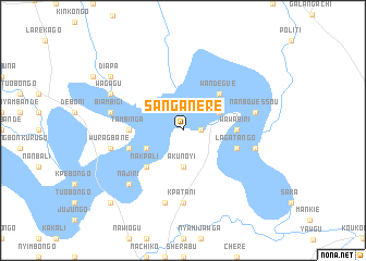
Sanganere (Ghana)Sanganere is a town in Ghana. An overview map of the region around Sanganere is displayed below.
regional and 3d topo map of Sanganere, Ghana ::
Sanganere airports ::
The nearest airport is LRL - Niatougou Niamtougou International, located 117.2 km south east of Sanganere.
Other airports nearby include TML - Tamale (152.1 km south west), OUA - Ouagadougou (288.1 km north west), Nearby towns ::
Jangbana (1.8km east) //
Akunoyi (3.7km south) //
Nangbande (4.1km south west) //
Wabiri (4.1km north east) //
Nakpali (5.2km south west) //
Wandégué (5.2km north east) //
Tambinga (5.5km west) //
Nachago (5.5km east) //
Wawabiri (5.5km east) //
Kpuloti (5.8km west) //
Lagatango (5.8km east) //
Kpatani (7.4km south) //
Biambigi (7.5km west) //
Wuragbane (7.5km west) //
Kpananbogu (7.6km south) //
Awareke (7.5km east) //
Kerkété (7.5km east) //
Nanbouéssou (7.5km east) //
Labanga (7.8km south west) //
Najiri (7.8km south west) //
Wagagu (8.2km north west) //
Diapa (9.2km north west) //
Tojenda (10.4km south west) //
[all distances 'as the bird flies' and approximate]  Places with similar names to Sanganere, Ghana ::
// Zenkanur (RU)
// Sanganoro (MG)
// San Nicanor (EC)
// Sānganer (IN)
// Sāngāner (IN)
// Sangginora (ID)
// Zangon Ara (NE)
// Sanganare (NG)
// Sangnae-ri (KP)
// Sŏngnae-ri (KP)
Disclaimer :: Information on this page comes without warranty of any kind |
||
|
Where is Sanganere? Elevation and coordinates ::
Latitude (lat): 10°24'0"N Longitude (lon): 0°14'0"W
Elevation (approx.): 141m (map arrows pan, magnifying glasses zoom) |
||
|
Visiting Sanganere? Hotel/Accommodation ::
Book a hotel in Sanganere Travel Guide ::
Buy a travel guide for Ghana rental cars ::
car rental offers GPS waypoint ::
download a GPX waypoint (PoI) of Sanganere for your GPS receiver
|
||