|
search place name
|
||
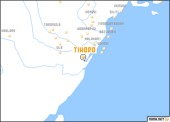
Tiworo (Indonesia)Tiworo is a town in Indonesia. An overview map of the region around Tiworo is displayed below.
regional and 3d topo map of Tiworo, Indonesia ::
Tiworo airports ::
The nearest airport is PSJ - Poso Kasiguncu, located 129.3 km west of Tiworo.
Other airports nearby include LUW - Luwuk Bubung (142.6 km north east), PLW - Palu Mutiara (227.6 km north west), Nearby towns ::
Tokala (4.1km north east) //
Malakani (4.1km north east) //
Uenasi (5.0km north east) //
Lorong (5.4km north) //
Ula (5.9km west) //
Woomparigi (5.9km north) //
Tokala Atas (6.0km north west) //
Watanaso (6.7km north west) //
Baturube (7.4km north east) //
Tambarobone (7.5km north west) //
Tirongan Atas (8.0km north) //
Posangke (8.2km north west) //
Parigi (8.8km north) //
Tirongan Bawah (9.2km north east) //
Taronggo (9.9km north west) //
Tondo (10.2km north west) //
[all distances 'as the bird flies' and approximate] 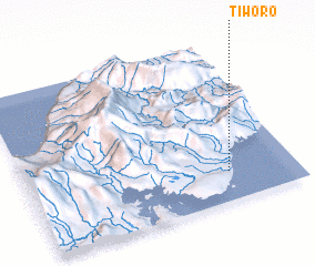 Places with similar names to Tiworo, Indonesia ::
Disclaimer :: Information on this page comes without warranty of any kind |
||
|
Where is Tiworo? Elevation and coordinates ::
Latitude (lat): 1°49'0"S Longitude (lon): 121°45'0"E
Elevation (approx.): 11m (map arrows pan, magnifying glasses zoom) |
||
|
Visiting Tiworo? Hotel/Accommodation ::
Book a hotel in Tiworo Travel Guide ::
Buy a travel guide for Indonesia rental cars ::
car rental offers GPS waypoint ::
download a GPX waypoint (PoI) of Tiworo for your GPS receiver
|
||