|
search place name
|
||
Podles (Macedonia, The Republic of)Podles is a town in Macedonia, The Republic of. An overview map of the region around Podles is displayed below.
regional and 3d topo map of Podles, Macedonia, The Republic of ::

Podles airports ::
The nearest airport is SKP - Skopje, located 50.8 km north of Podles.
Other airports nearby include OHD - Ohrid (98.0 km south west), KSO - Kastoria Aristotelis (128.3 km south), PRN - Pristina (132.8 km north west), KZI - Kozani Filippos (138.0 km south), Nearby towns ::
Krnino (3.4km west) //
Gorno Čičevo (4.6km north east) //
Popadija (4.8km south west) //
Dvorište (5.8km north) //
Mrzen Oraovec (5.8km south east) //
Krajnici (5.8km north west) //
Dolno Čičevo (5.4km north east) //
Kruševica (5.4km east) //
(( Dolno Trlo )) (7.0km south west) //
Skačinci (8.0km north) //
Sirkovo (6.4km east) //
Fariš (8.5km south) //
Vladilovci (6.5km west) //
Svećani (8.3km north) //
Vodovrati (7.9km north east) //
Kamen Dol (8.3km south east) //
Debrište (9.3km south east) //
Vojnica (10.1km north west) //
Viničani (10.5km north east) //
[all distances 'as the bird flies' and approximate] 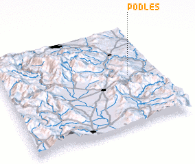 Places with similar names to Podles, Macedonia, The Republic of ::
Disclaimer :: Information on this page comes without warranty of any kind |
||
|
Where is Podles? Elevation and coordinates ::
Latitude (lat): 41°31'42"N Longitude (lon): 21°49'4"E
Elevation (approx.): 643m (map arrows pan, magnifying glasses zoom) |
||
|
Visiting Podles? Hotel/Accommodation ::
Book a hotel in Podles Travel Guide ::
rental cars ::
car rental offers GPS waypoint ::
download a GPX waypoint (PoI) of Podles for your GPS receiver
|
||