|
search place name
|
||
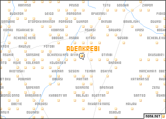
Adenkrebi (Ghana)Adenkrebi is a town in Ghana. An overview map of the region around Adenkrebi is displayed below.
regional and 3d topo map of Adenkrebi, Ghana ::
Adenkrebi airports ::
The nearest airport is ACC - Accra Kotoka Intl, located 20.0 km south of Adenkrebi.
Other airports nearby include LFW - Lome Gnassingbe Eyadema Intl (166.5 km east), TKD - Takoradi (200.2 km south west), Nearby towns ::
Aiyim (1.8km west) //
Aiyimensa (1.8km east) //
Obome (1.9km north) //
Ajimenti (1.9km north) //
Mpekadam (2.6km north west) //
Peduasi (2.6km north east) //
Kpomkpo (3.7km south) //
Nsaki (3.7km west) //
Kweman (3.7km east) //
Danfa (3.7km east) //
Kunkunu (3.7km north) //
Sesemi (4.1km south west) //
Berekuso (4.1km south west) //
Teiman (4.1km south east) //
Nsaba (4.1km north west) //
Kokobin (4.1km north west) //
Kitasi (4.1km north east) //
Bribon (5.2km north east) //
Pantan (5.6km south) //
Abokobi (5.6km south) //
Ochirekumfo (5.5km west) //
Otinibi (5.5km east) //
Kojokrom (5.8km west) //
Nsuasi (5.9km north) //
Oyamfa (5.9km south) //
Aburiamanfu (6.7km north west) //
Wiriman (6.7km south west) //
Dedeman (6.7km south west) //
Lateman (6.7km south east) //
[all distances 'as the bird flies' and approximate]  Places with similar names to Adenkrebi, Ghana ::
// Autengrub (AT)
Disclaimer :: Information on this page comes without warranty of any kind |
||
|
Where is Adenkrebi? Elevation and coordinates ::
Latitude (lat): 5°47'0"N Longitude (lon): 0°12'0"W
Elevation (approx.): 304m (map arrows pan, magnifying glasses zoom) |
||
|
Visiting Adenkrebi? Hotel/Accommodation ::
Book a hotel in Adenkrebi Travel Guide ::
Buy a travel guide for Ghana rental cars ::
car rental offers GPS waypoint ::
download a GPX waypoint (PoI) of Adenkrebi for your GPS receiver
|
||