|
search place name
|
||
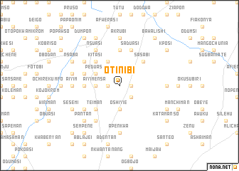
Otinibi (Ghana)Otinibi is a town in Ghana. An overview map of the region around Otinibi is displayed below.
regional and 3d topo map of Otinibi, Ghana ::
Otinibi airports ::
The nearest airport is ACC - Accra Kotoka Intl, located 19.8 km south of Otinibi.
Other airports nearby include LFW - Lome Gnassingbe Eyadema Intl (161.1 km east), TKD - Takoradi (205.1 km south west), Nearby towns ::
Danfa (1.8km west) //
Malijaw (1.8km east) //
Kweman (1.8km west) //
Amrahia (2.6km south east) //
Lateman (3.7km south) //
Oshiyie (3.7km south) //
Aiyimensa (3.7km west) //
Peduasi (4.1km north west) //
Bribon (4.1km north west) //
Teiman (5.2km south west) //
Oyibi (5.2km north east) //
Sasabi (5.2km north east) //
Kitasi (5.2km north west) //
Adamrobe (5.6km north) //
Adenkrebi (5.5km west) //
Saduasi (5.9km north) //
Akwani (5.9km north) //
Obome (5.8km west) //
Ajimenti (5.8km west) //
Nsuasi (6.7km north west) //
Oyamfa (6.7km south west) //
Kpomkpo (6.7km south west) //
Kunkunu (6.7km north west) //
Apenkwa (7.4km south) //
Akrubi (7.4km north) //
Afianya (7.4km east) //
Aiyim (7.4km west) //
Mpekadam (7.6km west) //
Abokobi (7.8km south west) //
[all distances 'as the bird flies' and approximate] 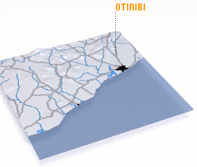
Disclaimer :: Information on this page comes without warranty of any kind |
||
|
Where is Otinibi? Elevation and coordinates ::
Latitude (lat): 5°47'0"N Longitude (lon): 0°9'0"W
Elevation (approx.): 85m (map arrows pan, magnifying glasses zoom) |
||
|
Visiting Otinibi? Hotel/Accommodation ::
Book a hotel in Otinibi Travel Guide ::
Buy a travel guide for Ghana rental cars ::
car rental offers GPS waypoint ::
download a GPX waypoint (PoI) of Otinibi for your GPS receiver
|
||