|
search place name
|
||
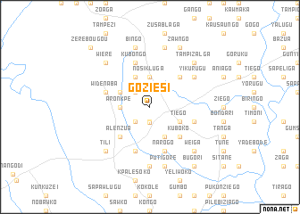
Goziesi (Ghana)Goziesi is a town in Ghana. An overview map of the region around Goziesi is displayed below.
regional and 3d topo map of Goziesi, Ghana ::
Goziesi airports ::
The nearest airport is TML - Tamale, located 156.9 km south of Goziesi.
Other airports nearby include OUA - Ouagadougou (190.9 km north west), LRL - Niatougou Niamtougou International (218.3 km south east), Nearby towns ::
Lamboya (1.9km south) //
Zebilla (2.0km south) //
Bezune (2.6km south west) //
Kukurizoga (2.6km north west) //
Aronkpe (3.6km west) //
Kamsango (3.7km north) //
Nosikluga (3.7km north) //
Bazunde (4.1km south east) //
Abeu (4.1km north west) //
Tiego (4.1km south east) //
Kogo (4.1km north west) //
Alenzua (5.2km south west) //
Kuboko (5.2km south east) //
Teshi (5.2km north east) //
Azupunpun (5.9km south) //
Sakom (5.8km east) //
Kubongo (5.9km north) //
Narogo (5.9km south) //
Gwosheshi (5.9km south) //
Widenaba (5.8km west) //
Yikurugu (6.6km north east) //
Atarakom (7.4km south) //
Kamega (7.4km south) //
Putigore (7.6km south) //
Bingo (7.6km north) //
Bougouré (7.6km north) //
Tili (7.8km south west) //
Weiga (7.8km south east) //
Wiere (7.8km north west) //
[all distances 'as the bird flies' and approximate] 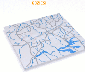 Places with similar names to Goziesi, Ghana ::
Disclaimer :: Information on this page comes without warranty of any kind |
||
|
Where is Goziesi? Elevation and coordinates ::
Latitude (lat): 10°56'0"N Longitude (lon): 0°31'0"W
Elevation (approx.): 215m (map arrows pan, magnifying glasses zoom) |
||
|
Visiting Goziesi? Hotel/Accommodation ::
Book a hotel in Goziesi Travel Guide ::
Buy a travel guide for Ghana rental cars ::
car rental offers GPS waypoint ::
download a GPX waypoint (PoI) of Goziesi for your GPS receiver
|
||