|
search place name
|
||
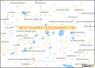
Benito Juárez Segunda Sección (Tabasco, Mexico)Benito Juárez Segunda Sección is a town in the Tabasco region of Mexico. An overview map of the region around Benito Juárez Segunda Sección is displayed below.
regional and 3d topo map of Benito Juárez Segunda Sección, Mexico ::
Benito Juárez Segunda Sección airports ::
The nearest airport is VSA - Villahermosa C P A Carlos Rovirosa Intl, located 43.8 km south east of Benito Juárez Segunda Sección.
Other airports nearby include MTT - Minatitlan (147.2 km west), CME - Ciudad Del Carmen Intl (156.7 km east), TGZ - Tuxtla Gutierrez Angel Albino Corzo (178.5 km south), Nearby towns ::
Benito Juárez Primera Sección (1.8km east) //
Huimango Segunda Sección (2.2km south west) //
Huimango Tercera Sección (2.3km south) //
Ayapa (3.2km north east) //
La Piedra Primera Sección (3.6km south west) //
Francisco Aquinuapa (3.8km south) //
La Gloria (3.8km south) //
Huapacal Segunda Sección (4.1km north east) //
Oriente Segunda Sección (4.2km north west) //
Oriente Tercera Sección (4.3km north west) //
San Diego (4.4km west) //
Pachucalco Segunda Sección (4.6km south) //
Oriente Quinta Sección (5.3km north west) //
Jerusalem (5.6km south) //
Calico Primera Sección (6.0km south east) //
La Piedra Segunda Sección (6.2km south west) //
Galeana Segunda Sección (6.2km east) //
Huapacal Primera Sección (6.5km north east) //
La Guadalupe (6.4km west) //
Sur Cuarta Sección (7.0km north west) //
San Miguel (7.5km north) //
Oriente Primera Sección (7.5km north) //
San Simón (7.5km north) //
El Cinco de Mayo (7.5km north) //
La Experiencia (7.5km south) //
Chacalapa Segunda Sección (7.2km east) //
Emiliano Zapata (7.4km south west) //
Sur Quinta Sección (7.9km north) //
La Chonita (7.6km west) //
[all distances 'as the bird flies' and approximate] 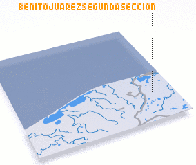 Places with similar names to Benito Juárez Segunda Sección, Mexico :: Disclaimer :: Information on this page comes without warranty of any kind |
||
|
Where is Benito Juárez Segunda Sección? Elevation and coordinates ::
Latitude (lat): 18°10'0"N Longitude (lon): 93°11'30"W
Elevation (approx.): 12m (map arrows pan, magnifying glasses zoom) |
||
|
Visiting Benito Juárez Segunda Sección? Hotel/Accommodation ::
Book a hotel in Benito Juárez Segunda Sección Travel Guide ::
Buy a travel guide for Mexico rental cars ::
car rental offers GPS waypoint ::
download a GPX waypoint (PoI) of Benito Juárez Segunda Sección for your GPS receiver
|
||