|
search place name
|
||
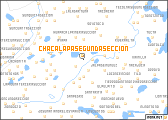
Chacalapa Segunda Sección (Tabasco, Mexico)Chacalapa Segunda Sección is a town in the Tabasco region of Mexico. An overview map of the region around Chacalapa Segunda Sección is displayed below.
regional and 3d topo map of Chacalapa Segunda Sección, Mexico ::
Chacalapa Segunda Sección airports ::
The nearest airport is VSA - Villahermosa C P A Carlos Rovirosa Intl, located 36.9 km south east of Chacalapa Segunda Sección.
Other airports nearby include CME - Ciudad Del Carmen Intl (150.6 km east), MTT - Minatitlan (154.2 km west), TGZ - Tuxtla Gutierrez Angel Albino Corzo (176.5 km south), Nearby towns ::
Chacalapa Primera Sección (1.8km east) //
Calico Primera Sección (2.2km south west) //
Galeana Segunda Sección (2.5km north) //
San Francisco (2.5km south) //
Vicente Guerrero Segunda Sección (3.7km south) //
Galeana Primera Sección (3.8km north east) //
Cúlico (4.3km south) //
El Clavo (4.6km north) //
Nicolas Bravo (4.5km east) //
Jalpa de Méndez (5.0km south east) //
Amatitán (5.0km south east) //
Huapacal Primera Sección (5.4km north) //
Vicente Guerrero Primera Sección (5.4km south) //
Huimango Primera Sección (5.6km south west) //
Ayapa (5.5km north west) //
Benito Juárez Primera Sección (5.6km west) //
Juárez (6.1km south) //
Pueblo Viejo (6.6km north east) //
La Gloria (6.6km west) //
El Río (7.1km east) //
Huimango Tercera Sección (7.1km west) //
Soyataco (7.4km north) //
Huapacal Segunda Sección (7.3km north west) //
Benito Juárez Segunda Sección (7.2km west) //
Pachucalco Primera Sección (7.8km south west) //
Pachucalco Segunda Sección (7.8km south west) //
El Púlpito (8.5km south east) //
Santa Rita (8.6km south) //
Francisco Aquinuapa (8.3km west) //
[all distances 'as the bird flies' and approximate] 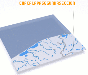 Places with similar names to Chacalapa Segunda Sección, Mexico :: Disclaimer :: Information on this page comes without warranty of any kind |
||
|
Where is Chacalapa Segunda Sección? Elevation and coordinates ::
Latitude (lat): 18°9'15"N Longitude (lon): 93°7'30"W
Elevation (approx.): 12m (map arrows pan, magnifying glasses zoom) |
||
|
Visiting Chacalapa Segunda Sección? Hotel/Accommodation ::
Book a hotel in Chacalapa Segunda Sección Travel Guide ::
Buy a travel guide for Mexico rental cars ::
car rental offers GPS waypoint ::
download a GPX waypoint (PoI) of Chacalapa Segunda Sección for your GPS receiver
|
||