|
search place name
|
||
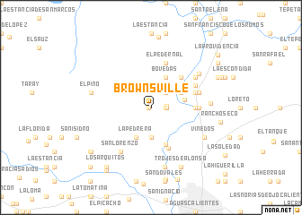
Brownsville (Aguascalientes, Mexico)Brownsville is a town in the Aguascalientes region of Mexico. An overview map of the region around Brownsville is displayed below.
regional and 3d topo map of Brownsville, Mexico ::
Brownsville airports ::
The nearest airport is AGU - Aguascalientes Jesus Teran Intl, located 32.8 km south of Brownsville.
Other airports nearby include ZCL - Zacatecas General Leobardo C Ruiz Intl (105.2 km north), BJX - Del Bajio Guanajuato Intl (143.3 km south east), SLP - San Luis Potosi Ponciano Arriaga Intl (149.1 km east), GDL - Guadalajara Don Miguel Hidalgo Y Costilla Intl (191.7 km south west), Nearby towns ::
El Chichimeco (0.3km west) //
Barranquilla (1.7km east) //
San Antonio de los Horcones (1.9km east) //
Loreto (1.9km east) //
La Granjita (2.5km north east) //
Jesús María (3.7km south) //
Bóvedas (4.1km north east) //
Valladolid (3.9km north east) //
La Pedrera (4.1km south west) //
El Chamizal (4.0km east) //
San Miguel (4.9km south) //
Valladolid (5.1km north east) //
Maravillas (5.5km south) //
Margaritas (5.2km east) //
El Pedernal (5.8km north) //
El Maguey (5.5km east) //
Jesús Gómez Portugal (5.6km east) //
El Maguey (5.9km north east) //
El Cortijo (5.9km east) //
El Cortijo (5.9km east) //
La Concepción (6.3km north east) //
San Lorenzo (6.5km south west) //
La Máquina (7.0km north east) //
Santa Fe (6.9km east) //
Viñedos (7.2km south east) //
Lumbreras (7.6km south) //
El Pino (7.1km west) //
Trojes de Alonso (8.2km south east) //
Rancho Seco (8.2km east) //
[all distances 'as the bird flies' and approximate] 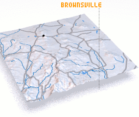 Places with similar names to Brownsville, Mexico ::
// Barnesville (US)
// Barnesville (US)
// Brownsville (US)
// Burnsville (US)
// Brownsville (US)
// Brownsville (US)
// Brownsville (US)
// Browns Valley (US)
// Brownsville (US)
// Barnesville (US)
Disclaimer :: Information on this page comes without warranty of any kind |
||
|
Where is Brownsville? Elevation and coordinates ::
Latitude (lat): 22°0'0"N Longitude (lon): 102°21'0"W
Elevation (approx.): 1898m (map arrows pan, magnifying glasses zoom) |
||
|
Visiting Brownsville? Hotel/Accommodation ::
Book a hotel in Brownsville Travel Guide ::
Buy a travel guide for Mexico rental cars ::
car rental offers GPS waypoint ::
download a GPX waypoint (PoI) of Brownsville for your GPS receiver
|
||