|
search place name
|
||
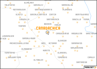
Cañada Chica (Hidalgo, Mexico)Cañada Chica is a town in the Hidalgo region of Mexico. An overview map of the region around Cañada Chica is displayed below.
regional and 3d topo map of Cañada Chica, Mexico ::
Cañada Chica airports ::
The nearest airport is PCA - Pachuca Ingeniero Juan Guillermo Villasana, located 30.9 km south east of Cañada Chica.
Other airports nearby include MEX - Mexico City Licenciado Benito Juarez Intl (97.2 km south), TXA - Tlaxcala (117.7 km south east), TLC - Toluca Licenciado Adolfo Lopez Mateos Intl (125.3 km south west), QRO - Queretaro Intercontinental (133.4 km west), Nearby towns ::
Dajedí (1.9km north east) //
Boxaxni (2.9km north) //
La Vega (3.6km west) //
Caxuxí (3.9km west) //
Xidejé (4.4km north east) //
Boxí (4.8km south) //
Actopan (4.8km south) //
Santa Mónica (5.1km north) //
Canguijuindó (5.3km east) //
La Estancia (5.3km east) //
El Bondhó (5.5km south west) //
Poxindeje (5.7km south west) //
El Sitio (5.7km north east) //
La Peña (6.2km south east) //
El Rincón (6.3km south east) //
Cañada Grande (6.4km west) //
El Mejé (6.7km south east) //
Contzá (6.9km north) //
El Jiadi (6.9km south) //
San Antonio Zaragoza (6.9km south west) //
Huaxtó (7.3km south) //
González Ortega (7.5km north west) //
Bothiban (7.6km south) //
San Salvador (7.4km west) //
Demacú (7.9km west) //
Santiago de Anaya (8.7km north) //
La Becerra (9.2km north) //
Santa María Amajac (9.7km south west) //
El Arenal (9.7km south east) //
[all distances 'as the bird flies' and approximate] 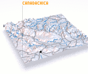 Places with similar names to Cañada Chica, Mexico ::
// Gando Tiaka (BJ)
// Kountchougou (BJ)
// Quinta Chica (EC)
// Gandu Chak (IN)
// Cañada Chica (MX)
// Cañada Chica (MX)
// Cañada Chica (UY)
// Kondeshkūh (IR)
// Gandoi Chauki (PK)
// Kande Chauki (PK)
Disclaimer :: Information on this page comes without warranty of any kind |
||
|
Where is Cañada Chica? Elevation and coordinates ::
Latitude (lat): 20°18'25"N Longitude (lon): 98°57'0"W
Elevation (approx.): 2029m (map arrows pan, magnifying glasses zoom) |
||
|
Visiting Cañada Chica? Hotel/Accommodation ::
Book a hotel in Cañada Chica Travel Guide ::
Buy a travel guide for Mexico rental cars ::
car rental offers GPS waypoint ::
download a GPX waypoint (PoI) of Cañada Chica for your GPS receiver
|
||