|
search place name
|
||
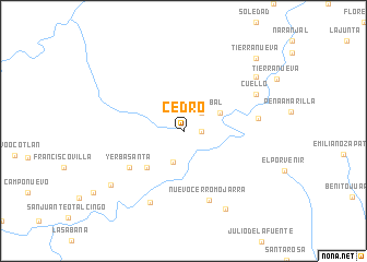
Cedro (Oaxaca, Mexico)Cedro is a town in the Oaxaca region of Mexico. An overview map of the region around Cedro is displayed below.
regional and 3d topo map of Cedro, Mexico ::
Cedro airports ::
The nearest airport is MTT - Minatitlan, located 104.3 km north east of Cedro.
Other airports nearby include OAX - Oaxaca Xoxocotlan Intl (157.2 km west), VER - Vera Cruz General Heriberto Jara Intl (200.9 km north west), HUX - Bahias Dehuatulco Bahias De Huatulco Intl (215.9 km south west), PXM - Puerto Escondido Intl (259.5 km south west), Nearby towns ::
Tepejilotal (1.8km east) //
El Guayabal (2.6km north east) //
San Felipe Zihualtepec (3.3km south) //
Coyote (4.0km north east) //
Borracho (5.1km south west) //
Yerba Santa (6.5km south west) //
Nuevo Cerro Mojarra (7.5km south) //
El Campanano (7.4km east) //
La Primavera (8.0km south west) //
Cuello (8.0km north east) //
Arroyo Encino (9.0km south east) //
Tierra Quemada (9.0km south west) //
La Guadalupe (9.0km north east) //
Tierra Nueva (10.2km north east) //
[all distances 'as the bird flies' and approximate]  Places with similar names to Cedro, Mexico ::
Disclaimer :: Information on this page comes without warranty of any kind |
||
|
Where is Cedro? Elevation and coordinates ::
Latitude (lat): 17°31'0"N Longitude (lon): 95°21'0"W
Elevation (approx.): 77m (map arrows pan, magnifying glasses zoom) |
||
|
Visiting Cedro? Hotel/Accommodation ::
Book a hotel in Cedro Travel Guide ::
Buy a travel guide for Mexico rental cars ::
car rental offers GPS waypoint ::
download a GPX waypoint (PoI) of Cedro for your GPS receiver
|
||