|
search place name
|
||
Charquillo (San Luis Potosí, Mexico)Charquillo is a town in the San Luis Potosí region of Mexico. An overview map of the region around Charquillo is displayed below.
regional and 3d topo map of Charquillo, Mexico ::

Charquillo airports ::
The nearest airport is SLP - San Luis Potosi Ponciano Arriaga Intl, located 66.3 km south of Charquillo.
Other airports nearby include ZCL - Zacatecas General Leobardo C Ruiz Intl (173.2 km west), AGU - Aguascalientes Jesus Teran Intl (185.8 km south west), BJX - Del Bajio Guanajuato Intl (211.5 km south), Nearby towns ::
San Pedro (2.5km north east) //
San Salvador (5.1km west) //
Purísima (5.8km south) //
Cardón (5.8km south) //
El Salitre (7.6km north west) //
Santa María (8.2km south west) //
Mexiquito (9.0km north west) //
Guadalupe (9.0km north west) //
Coronado (10.1km north east) //
[all distances 'as the bird flies' and approximate] 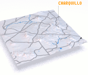 Places with similar names to Charquillo, Mexico ::
// Shyrokyy Luh (UA)
// Charkli (RU)
// Charīklū (IR)
// Chārqolī (IR)
// Charāikol (BD)
// Chāraikola (BD)
// Char Goāli (BD)
// Char Kāli (BD)
// Char Kāli (BD)
// Churigualla (CL)
Disclaimer :: Information on this page comes without warranty of any kind |
||
|
Where is Charquillo? Elevation and coordinates ::
Latitude (lat): 22°51'0"N Longitude (lon): 101°0'0"W
Elevation (approx.): 1651m (map arrows pan, magnifying glasses zoom) |
||
|
Visiting Charquillo? Hotel/Accommodation ::
Book a hotel in Charquillo Travel Guide ::
Buy a travel guide for Mexico rental cars ::
car rental offers GPS waypoint ::
download a GPX waypoint (PoI) of Charquillo for your GPS receiver
|
||