|
search place name
|
||
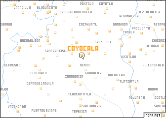
Coyocala (Hidalgo, Mexico)Coyocala is a town in the Hidalgo region of Mexico. An overview map of the region around Coyocala is displayed below.
regional and 3d topo map of Coyocala, Mexico ::
Coyocala airports ::
The nearest airport is PCA - Pachuca Ingeniero Juan Guillermo Villasana, located 97.9 km south of Coyocala.
Other airports nearby include TSL - Tamuin (120.2 km north), QRO - Queretaro Intercontinental (139.6 km west), PAZ - Poza Rico Tajin (154.3 km east), MEX - Mexico City Licenciado Benito Juarez Intl (169.2 km south), Nearby towns ::
Nuevo Reynosa (1.7km north east) //
Nemixi (2.5km south) //
Choquintla (2.6km north west) //
Nuevo Zacatlán (3.3km south west) //
Xilocuatitla (3.9km north west) //
Las Moritas (4.0km north) //
Ixcuicuila (4.8km east) //
Guadalupe (5.0km south east) //
Zaragoaza (5.4km south) //
Xoquintla (5.4km north west) //
San Miguel (5.3km north east) //
Acapa (5.7km south) //
San Francisco (5.5km west) //
Tetla (6.3km south east) //
Chilijapa (6.5km north east) //
Cazahuatl (6.9km north) //
Ahuehueco (7.2km north) //
Dominí (7.8km north west) //
Tepehuacán de Guerrero (8.5km north east) //
La Ventana (8.4km north west) //
Buenavista (8.6km north west) //
Xuchitlán (8.7km south east) //
Tepehuacán de Guerrero (8.6km east) //
Los Santos (8.9km north east) //
San Nicolás (9.3km south east) //
Agua Fría (9.0km north west) //
San Antonio (9.2km south east) //
El Durazno (9.5km north west) //
Chotipa (9.6km north west) //
[all distances 'as the bird flies' and approximate]  Places with similar names to Coyocala, Mexico ::
Disclaimer :: Information on this page comes without warranty of any kind |
||
|
Where is Coyocala? Elevation and coordinates ::
Latitude (lat): 20°57'20"N Longitude (lon): 98°53'40"W
Elevation (approx.): 1775m (map arrows pan, magnifying glasses zoom) |
||
|
Visiting Coyocala? Hotel/Accommodation ::
Book a hotel in Coyocala Travel Guide ::
Buy a travel guide for Mexico rental cars ::
car rental offers GPS waypoint ::
download a GPX waypoint (PoI) of Coyocala for your GPS receiver
|
||