|
search place name
|
||
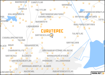
Cuautepec (Distrito Federal, Mexico)Cuautepec is a town in the Distrito Federal region of Mexico. An overview map of the region around Cuautepec is displayed below.
regional and 3d topo map of Cuautepec, Mexico ::
Cuautepec airports ::
The nearest airport is MEX - Mexico City Licenciado Benito Juarez Intl, located 15.8 km south east of Cuautepec.
Other airports nearby include TLC - Toluca Licenciado Adolfo Lopez Mateos Intl (52.1 km south west), PCA - Pachuca Ingeniero Juan Guillermo Villasana (67.4 km north east), CVJ - Cuernavaca General Mariano Matamoros (82.1 km south), PBC - Puebla Hermanos Serdan Intl (91.9 km south east), Nearby towns ::
Santa Cecilia (3.5km west) //
Santa Cecilia Acatitlán (4.0km south west) //
San Andrés de la Cañada (4.1km east) //
Santa Rosa (5.1km south west) //
Santa María Ticomán (5.6km south) //
Ciudad Labor (5.6km north west) //
Progreso Nacional (5.8km south) //
Escalera (5.8km south) //
Buenavista (6.0km north west) //
San Mateo Cuautepec (6.6km north) //
Cuidad Labor (7.0km north) //
Santa María Guadalupe (6.8km west) //
Santa María Cuautepec (7.4km north) //
Barrientos (7.0km west) //
San Pedro Zacatenco (7.6km south) //
San Bartolo Atepehuacán (7.6km south) //
Coacalco (7.6km north) //
Santa Clara (7.3km east) //
La Quebrada (7.3km north west) //
Xalostoc (7.6km south east) //
San Felipe de Jesús (7.6km south east) //
Juan Romero González (8.2km south east) //
Gabriel Hernández (8.2km south east) //
Gabriel Hernández Ampliación (8.2km south east) //
Nueva Atzacoalco (8.2km south east) //
Seguro Social (7.9km south west) //
Reinosa Tamaulipas (9.1km south west) //
San Jerónimo Tepetlacalco (8.9km south west) //
Tepalcapa (8.9km north west) //
[all distances 'as the bird flies' and approximate] 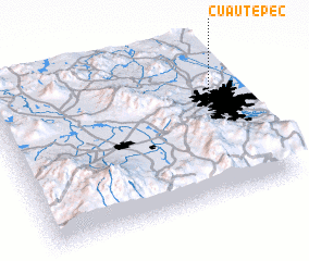 Places with similar names to Cuautepec, Mexico ::
// Kutapic (PH)
// Kadapiku (EE)
// Coatepeque (SV)
// Coatepeque (GT)
// Coatepeque (GT)
// Cotpuuk (ID)
// Coatepec (MX)
// Coatepec (MX)
// Coatepec (MX)
// Coatepec (MX)
Disclaimer :: Information on this page comes without warranty of any kind |
||
|
Where is Cuautepec? Elevation and coordinates ::
Latitude (lat): 19°34'0"N Longitude (lon): 99°8'0"W
Elevation (approx.): 2334m (map arrows pan, magnifying glasses zoom) |
||
|
Visiting Cuautepec? Hotel/Accommodation ::
Book a hotel in Cuautepec Travel Guide ::
Buy a travel guide for Mexico rental cars ::
car rental offers GPS waypoint ::
download a GPX waypoint (PoI) of Cuautepec for your GPS receiver
|
||