|
search place name
|
||
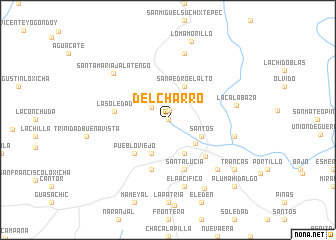
Del Charro (Oaxaca, Mexico)Del Charro is a town in the Oaxaca region of Mexico. An overview map of the region around Del Charro is displayed below.
regional and 3d topo map of Del Charro, Mexico ::
Del Charro airports ::
The nearest airport is HUX - Bahias Dehuatulco Bahias De Huatulco Intl, located 33.0 km south east of Del Charro.
Other airports nearby include PXM - Puerto Escondido Intl (65.9 km west), OAX - Oaxaca Xoxocotlan Intl (115.5 km north), Nearby towns ::
Potrero (0.0km north) //
Llano de Flor (1.1km north) //
Espinazo del Diablo (2.2km north west) //
El Felix (3.9km south east) //
Santos (4.0km south east) //
Copalita (4.1km south east) //
La Galera (4.1km south west) //
San Pedro el Alto (4.1km north east) //
Pueblo Viejo (5.1km south west) //
Cruz Grande (5.7km south east) //
Santa Lucía (5.8km south) //
San Isidro (5.8km south) //
La Soledad (5.9km west) //
Colonia (7.6km south) //
El Pacífico (7.6km south) //
Loma Aguacatado (7.4km east) //
San José (7.6km north) //
La Calabaza (7.5km east) //
Constancia (7.7km south east) //
Santa María Jalatengo (7.8km north west) //
Independencia (8.6km south east) //
Loma Morillo (9.1km north) //
Trancas (9.0km south east) //
Pluma Hidalgo (10.3km south east) //
[all distances 'as the bird flies' and approximate] 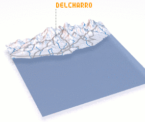 Places with similar names to Del Charro, Mexico ::
// Tolosher' (RU)
// Toloshur (RU)
// Delshire (US)
// Dalshor (RU)
// Daluchari (BD)
// Daluchari (BD)
// Tālcher (IN)
// Tellicherry (IN)
// Towlshīrī (IR)
// Tallo Shoro (PK)
Disclaimer :: Information on this page comes without warranty of any kind |
||
|
Where is Del Charro? Elevation and coordinates ::
Latitude (lat): 15°59'0"N Longitude (lon): 96°29'0"W
Elevation (approx.): 1268m (map arrows pan, magnifying glasses zoom) |
||
|
Visiting Del Charro? Hotel/Accommodation ::
Book a hotel in Del Charro Travel Guide ::
Buy a travel guide for Mexico rental cars ::
car rental offers GPS waypoint ::
download a GPX waypoint (PoI) of Del Charro for your GPS receiver
|
||