|
search place name
|
||
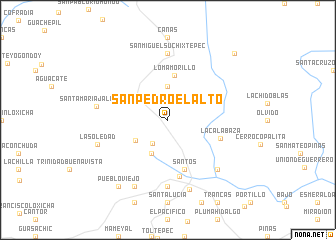
San Pedro el Alto (Oaxaca, Mexico)San Pedro el Alto is a town in the Oaxaca region of Mexico. An overview map of the region around San Pedro el Alto is displayed below.
regional and 3d topo map of San Pedro el Alto, Mexico ::
San Pedro el Alto airports ::
The nearest airport is HUX - Bahias Dehuatulco Bahias De Huatulco Intl, located 34.5 km south east of San Pedro el Alto.
Other airports nearby include PXM - Puerto Escondido Intl (68.4 km west), OAX - Oaxaca Xoxocotlan Intl (112.3 km north), Nearby towns ::
Llano de Flor (3.1km south west) //
San José (3.7km north) //
Potrero (4.1km south west) //
Del Charro (4.1km south west) //
Espinazo del Diablo (4.2km south west) //
Loma Morillo (5.1km north) //
Santos (5.8km south) //
La Calabaza (6.0km east) //
El Felix (6.4km south) //
San Miguel Suchixtepec (7.4km north) //
Copalita (7.4km south) //
Loma Aguacatado (7.7km south east) //
Santa María Jalatengo (7.8km west) //
Cruz Grande (8.1km south) //
La Galera (8.2km south west) //
La Soledad (8.1km west) //
Pueblo Viejo (9.1km south west) //
San Marcial Ozolotepec (10.3km north east) //
[all distances 'as the bird flies' and approximate]  Places with similar names to San Pedro el Alto, Mexico ::
// San Pedro el Alto (MX)
// San Pedro el Alto (MX)
// San Pedro El Alto (MX)
// San Pedro El Alto (MX)
Disclaimer :: Information on this page comes without warranty of any kind |
||
|
Where is San Pedro el Alto? Elevation and coordinates ::
Latitude (lat): 16°1'0"N Longitude (lon): 96°28'0"W
Elevation (approx.): 1870m (map arrows pan, magnifying glasses zoom) |
||
|
Visiting San Pedro el Alto? Hotel/Accommodation ::
Book a hotel in San Pedro el Alto Travel Guide ::
Buy a travel guide for Mexico rental cars ::
car rental offers GPS waypoint ::
download a GPX waypoint (PoI) of San Pedro el Alto for your GPS receiver
|
||