|
search place name
|
||
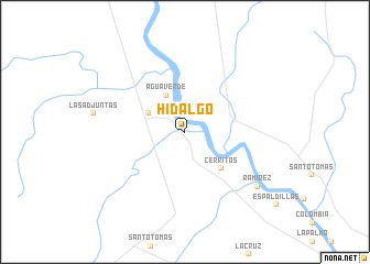
Hidalgo (Coahuila de Zaragoza, Mexico)Hidalgo is a town in the Coahuila de Zaragoza region of Mexico. An overview map of the region around Hidalgo is displayed below.
regional and 3d topo map of Hidalgo, Mexico ::
Hidalgo airports ::
The nearest airport is NLD - Nuevo Laredo Quetzalcoatl Intl, located 47.6 km south east of Hidalgo.
Other airports nearby include LRD - Laredo Intl (48.0 km south east), PDS - Piedras Negras Intl (114.3 km north west), ALI - Alice Intl (181.4 km east), LOV - Monclova Intl (183.2 km south west), Nearby towns ::
Palafox (1.9km north) //
San Enrique (2.5km north west) //
Encinos (3.8km north west) //
Merita (3.8km north west) //
Agua Verde (4.1km north west) //
Cerritos (4.9km south east) //
Ramírez (8.6km south east) //
[all distances 'as the bird flies' and approximate] 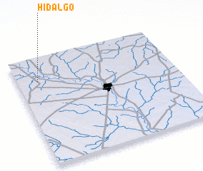 Places with similar names to Hidalgo, Mexico ::
// Hoddelke (DE)
// Hidalgo (US)
// Hattelek (HU)
// Hidalgo (ES)
// Hidalgo (US)
// White Lake (US)
// White Lake (US)
// Hot Lake (US)
// Hood Lake (US)
// Whitlock (US)
Disclaimer :: Information on this page comes without warranty of any kind |
||
|
Where is Hidalgo? Elevation and coordinates ::
Latitude (lat): 27°47'0"N Longitude (lon): 99°52'0"W
Elevation (approx.): 147m (map arrows pan, magnifying glasses zoom) |
||
|
Visiting Hidalgo? Hotel/Accommodation ::
Book a hotel in Hidalgo Travel Guide ::
Buy a travel guide for Mexico rental cars ::
car rental offers GPS waypoint ::
download a GPX waypoint (PoI) of Hidalgo for your GPS receiver
|
||