|
search place name
|
||
Huacapa (Oaxaca, Mexico)Huacapa is a town in the Oaxaca region of Mexico. An overview map of the region around Huacapa is displayed below.
regional and 3d topo map of Huacapa, Mexico ::

Huacapa airports ::
The nearest airport is TCN - Tehuacan, located 134.3 km north east of Huacapa.
Other airports nearby include CVJ - Cuernavaca General Mariano Matamoros (170.7 km north west), PBC - Puebla Hermanos Serdan Intl (171.9 km north), OAX - Oaxaca Xoxocotlan Intl (178.6 km east), ACA - Acapulco General Juan N Alvarez Intl (182.6 km south west), Nearby towns ::
San Vicente del Zapote (3.0km west) //
Santiago Guadalupe (3.7km west) //
Santa Rosa de Juárez (5.4km east) //
La Libertad (5.8km south west) //
Santiago Niño La Raya (6.1km south east) //
Santa Cruz de Bravo (6.5km east) //
San José Sabinillo (6.7km south east) //
La Luz Tenexcalco (7.4km north west) //
San Juan Bautista Tlachichilco (8.4km south west) //
San Miguel Ahuehuetitlán (8.7km north) //
Santiago Tamazola (9.7km north east) //
[all distances 'as the bird flies' and approximate] 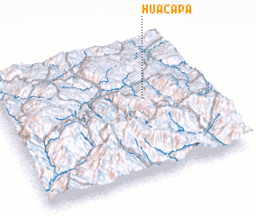 Places with similar names to Huacapa, Mexico ::
Disclaimer :: Information on this page comes without warranty of any kind |
||
|
Where is Huacapa? Elevation and coordinates ::
Latitude (lat): 17°36'28"N Longitude (lon): 98°16'59"W
Elevation (approx.): 1432m (map arrows pan, magnifying glasses zoom) |
||
|
Visiting Huacapa? Hotel/Accommodation ::
Book a hotel in Huacapa Travel Guide ::
Buy a travel guide for Mexico rental cars ::
car rental offers GPS waypoint ::
download a GPX waypoint (PoI) of Huacapa for your GPS receiver
|
||